MyTopo
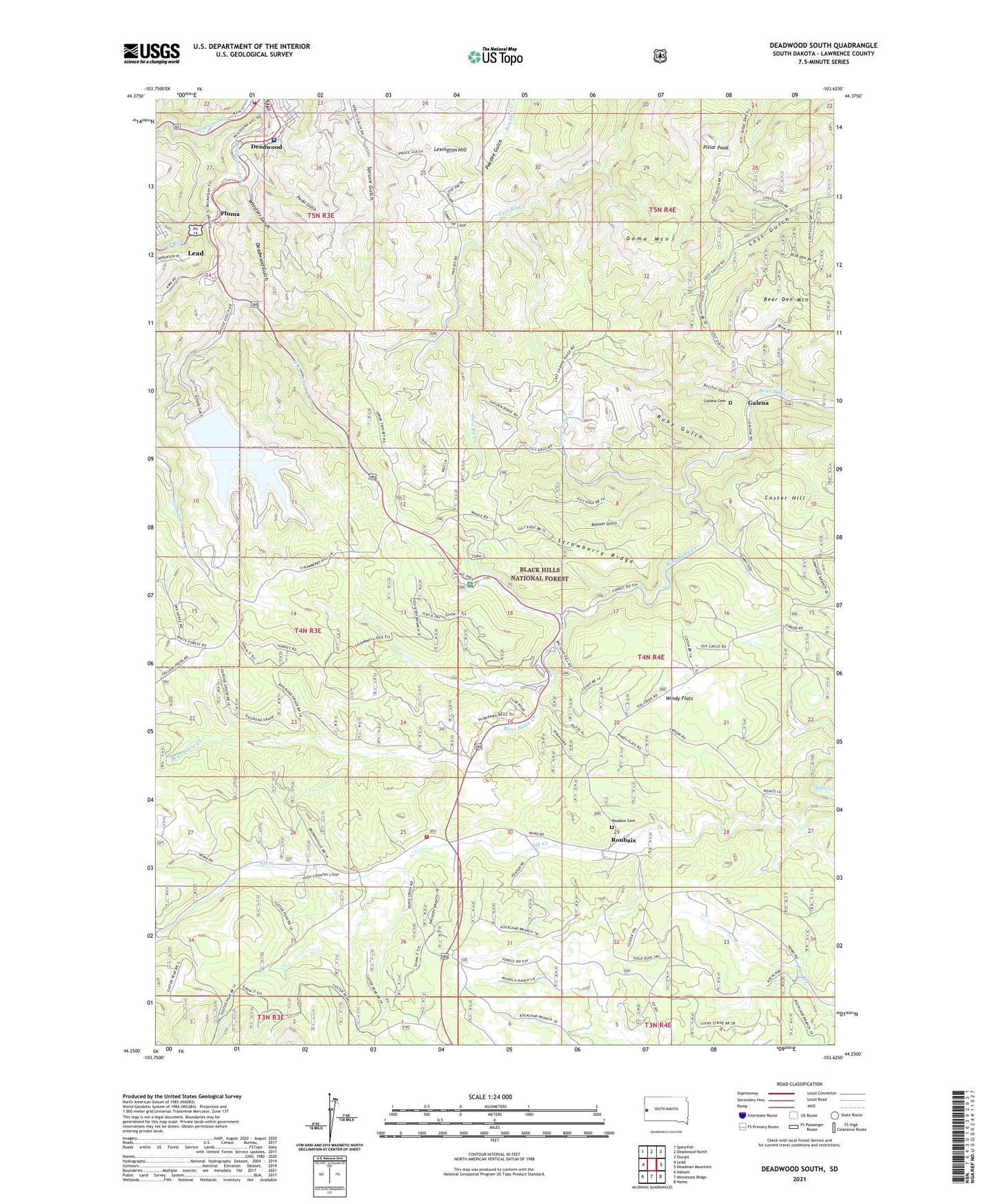
Deadwood South South Dakota US Topo Map
Couldn't load pickup availability
Also explore the Deadwood South Forest Service Topo of this same quad for updated USFS data
2021 topographic map quadrangle Deadwood South in the state of South Dakota. Scale: 1:24000. Based on the newly updated USGS 7.5' US Topo map series, this map is in the following counties: Lawrence. The map contains contour data, water features, and other items you are used to seeing on USGS maps, but also has updated roads and other features. This is the next generation of topographic maps. Printed on high-quality waterproof paper with UV fade-resistant inks.
Quads adjacent to this one:
West: Lead
Northwest: Spearfish
North: Deadwood North
Northeast: Sturgis
East: Deadman Mountain
Southeast: Nemo
South: Minnesota Ridge
Southwest: Nahant
This map covers the same area as the classic USGS quad with code o44103c6.
Contains the following named places: Alexander Mine, Alice Mine, Allerton, Anchor Hill, Anchor Mountain Mine, Bear Den Mountain, Belle Eldridge Gold Mine, Bion Mine, Boomer Gulch, Branch Mint Mine, Brownsville, Brownsville Volunteer Fire Department, Bucks, Bullion Mine, Butcher Gulch, Camp Galena Post Office, Carterville, Clover Leaf Mine, Coletta Mine, Cora Mine, Custer Hill, Custer Mine, Deadwood City Hall, Deadwood Creek, Deadwood Gulch, Deadwood Police Department, Deadwood Volunteer Fire Department, Dome Mountain, Double Rainbow Mine, El Refugio Mine, Florence Mine, Galena, Galena Cemetery, Galena Junction, Gilt Edge Mine, Gold Mountain Mine, Gold Run, Golden Crest Mine, Grizzly Gulch, Groshong Mine, Hardin Properties Mine, Hayes Mine, Hester A Mine, Historic Adams House, Hoffman Iron Deposit Mine, Hoodoo-Union Hill Mine, Horseshoe-Comet Mine, Lawrence County Jail, Lawrence County Sheriff's Office, Lead - Deadwood Regional Hospital, Lexington Hill, Lexington Hill Mine, Mary Mine, Mascot Mine, Merritt Number 1 and Merritt Number 2 Mine, Monarch Mine, Montezuma and the Whizzers Mine, Olaf Seim Mine, Oro Fino, Oro Hondo Mine, Pecks Gulch, Pillar Peak, Pluma, Puritan Mine, Rattle Snake Jack Mine, Red Cloud Mine, Roubaix, Roubaix Cemetery, Ruby Gulch, S R Smith Mine, Savage Mine, Sheeps Trail, Silver Queen Mine, Slavonian Mine, State Park Post Office, Strawberry Creek, Strawberry Hill Campground, Strawberry Ridge, Strawberry Spur, The Chicken Ranch, Tomahawk Country Club, Twobit, Virginia, War Eagle Mine, West Strawberry Creek, Whistler Gulch, Whitetail, Windy Flats