MyTopo
Minnesota Ridge South Dakota US Topo Map
Couldn't load pickup availability
Also explore the Minnesota Ridge Forest Service Topo of this same quad for updated USFS data
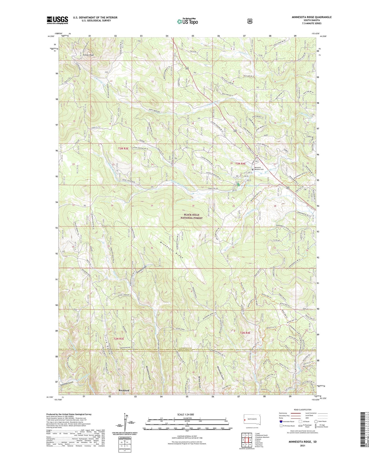
2021 topographic map quadrangle Minnesota Ridge in the state of South Dakota. Scale: 1:24000. Based on the newly updated USGS 7.5' US Topo map series, this map is in the following counties: Lawrence, Pennington. The map contains contour data, water features, and other items you are used to seeing on USGS maps, but also has updated roads and other features. This is the next generation of topographic maps. Printed on high-quality waterproof paper with UV fade-resistant inks.
Quads adjacent to this one:
West: Nahant
Northwest: Lead
North: Deadwood South
Northeast: Deadman Mountain
East: Nemo
Southeast: Silver City
South: Rochford
Southwest: Deerfield
This map covers the same area as the classic USGS quad with code o44103b6.
Contains the following named places: Albany, Black Hills Experimental Forest, Boxelder School, Buchholz, Camp Collins, Camp Paha Sapa, Custer Crossing Picnic Area, Custer Lookout Tower, Custer Peak, Diamond City, Green Mountain, Greens Gulch, Gregory, Minnesota Ridge, Montana Mine, Mountain Meadow Cemetery, Mountain Meadows, Naoby, North Fork Rapid Creek, Ochre City, Olsen, Roubaix Lake, Roubaix Lake Campground, Roubaix Lake Dam, Solomon Gulch, South Fork Rapid Creek, ZIP Code: 57732