MyTopo
Oak Hollow South Dakota US Topo Map
Couldn't load pickup availability
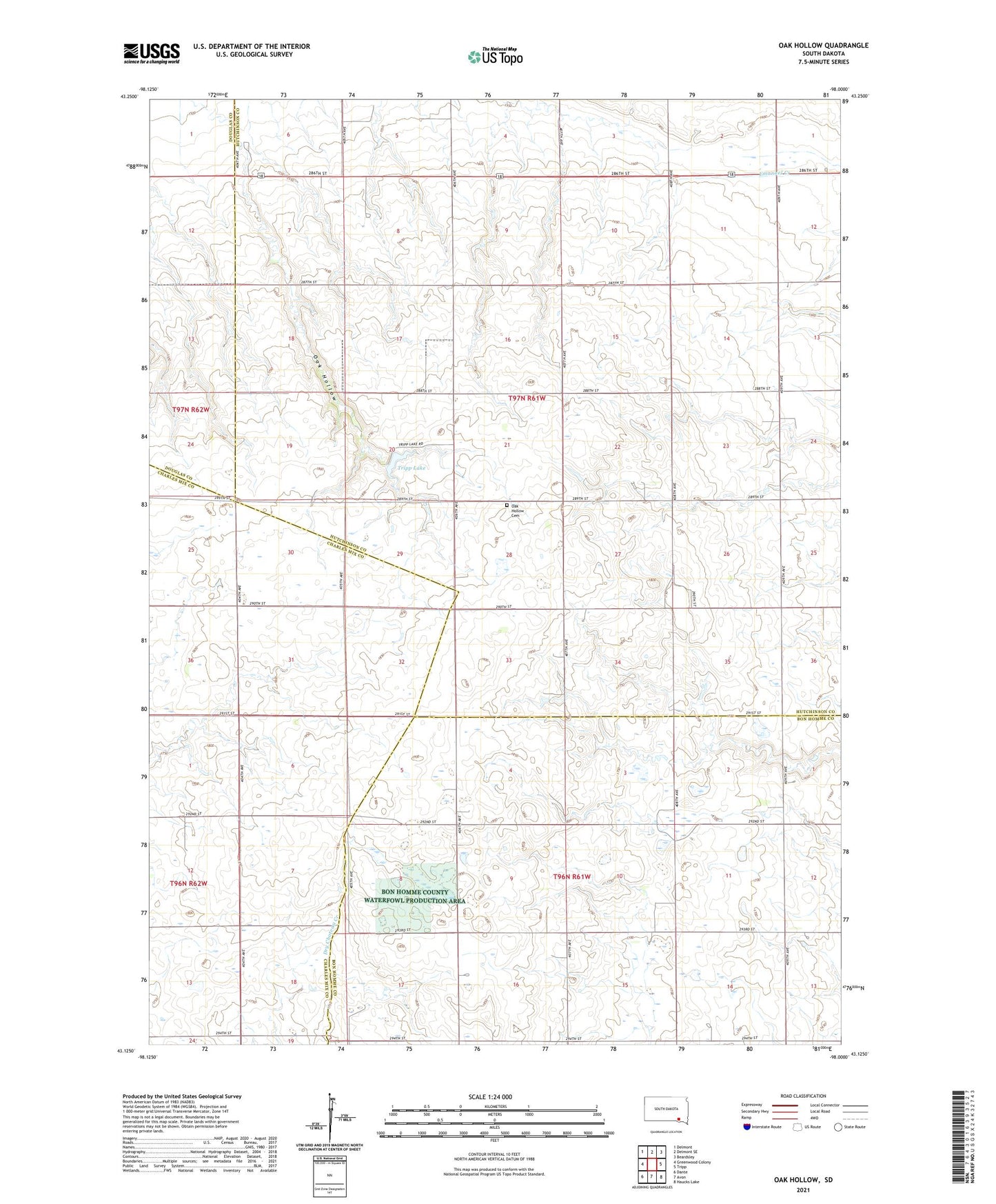
2021 topographic map quadrangle Oak Hollow in the state of South Dakota. Scale: 1:24000. Based on the newly updated USGS 7.5' US Topo map series, this map is in the following counties: Hutchinson, Bon Homme, Charles Mix, Douglas. The map contains contour data, water features, and other items you are used to seeing on USGS maps, but also has updated roads and other features. This is the next generation of topographic maps. Printed on high-quality waterproof paper with UV fade-resistant inks.
Quads adjacent to this one:
West: Greenwood Colony
Northwest: Delmont
North: Delmont SE
Northeast: Beardsley
East: Tripp
Southeast: Haucks Lake
South: Avon
Southwest: Dante
Contains the following named places: Oak Hollow, Oak Hollow Cemetery, School Number 49, School Number 65, Township of Monroe, Township of Oak Hollow, Tripp Dam, Tripp Lake