MyTopo
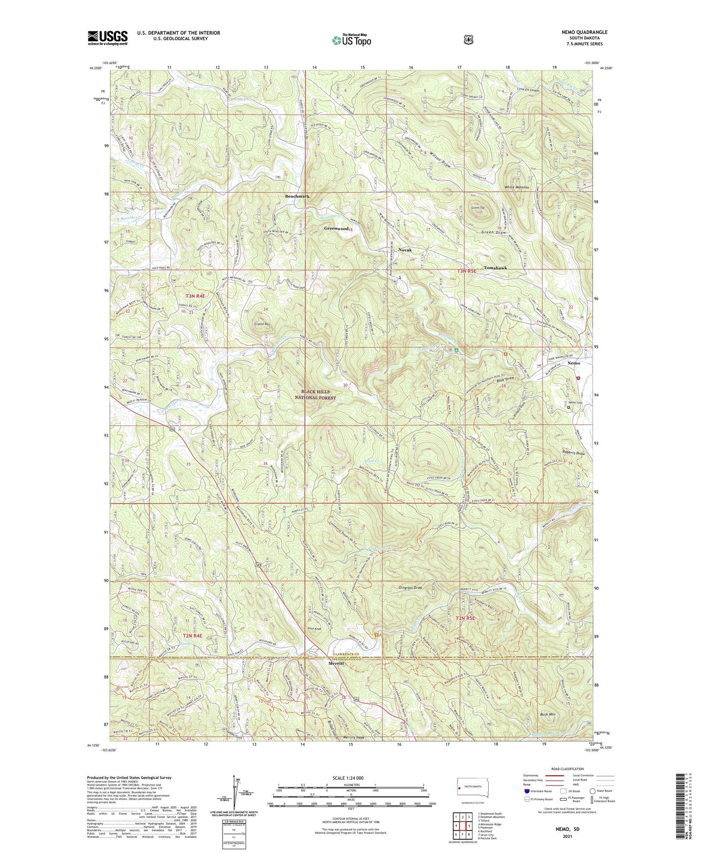
Nemo South Dakota US Topo Map
Couldn't load pickup availability
Also explore the Nemo Forest Service Topo of this same quad for updated USFS data
2021 topographic map quadrangle Nemo in the state of South Dakota. Scale: 1:24000. Based on the newly updated USGS 7.5' US Topo map series, this map is in the following counties: Lawrence, Pennington. The map contains contour data, water features, and other items you are used to seeing on USGS maps, but also has updated roads and other features. This is the next generation of topographic maps. Printed on high-quality waterproof paper with UV fade-resistant inks.
Quads adjacent to this one:
West: Minnesota Ridge
Northwest: Deadwood South
North: Deadman Mountain
Northeast: Tilford
East: Piedmont
Southeast: Pactola Dam
South: Silver City
Southwest: Rochford
This map covers the same area as the classic USGS quad with code o44103b5.
Contains the following named places: Benchmark, Blue Draw, Box Elder Forks Campground, Boxelder Camp, Boxelder Civilian Conservation Center, Buck Mountain, Channing, Corral Creek, Crystal Mountain, Gingrass Draw, Green Draw, Green Top, Greenwood, Hay Creek, Hill Side School, Lucky Strike Mine, Merritt, Middle Boxelder Creek, Nemo, Nemo Cemetery, Nemo Post Office, Nemo Volunteer Fire Department, Nemo Work Center, North Boxelder Creek, North Fork Estes Creek, Novak, Pilot Knob, Richard Draw, Roberts Draw, Silver Arrow Trail, Slabtown, South Boxelder Creek, South Boxelder Summer Home Group, String Town Logging Camp, Tomahawk, West Fork Estes Creek, White Mansion, Wilson Draw, ZIP Code: 57759