MyTopo
Scotland South Dakota US Topo Map
Couldn't load pickup availability
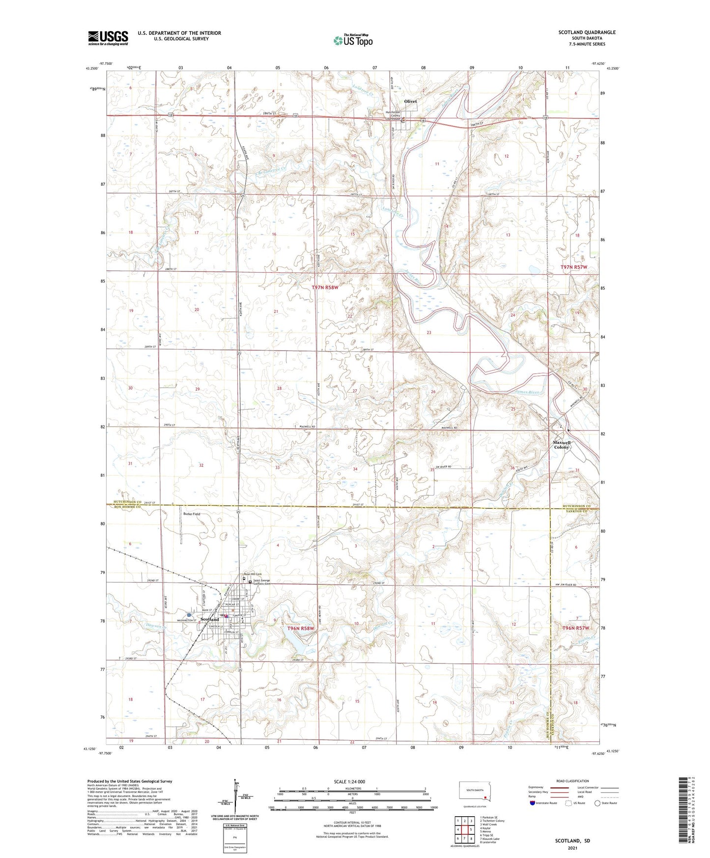
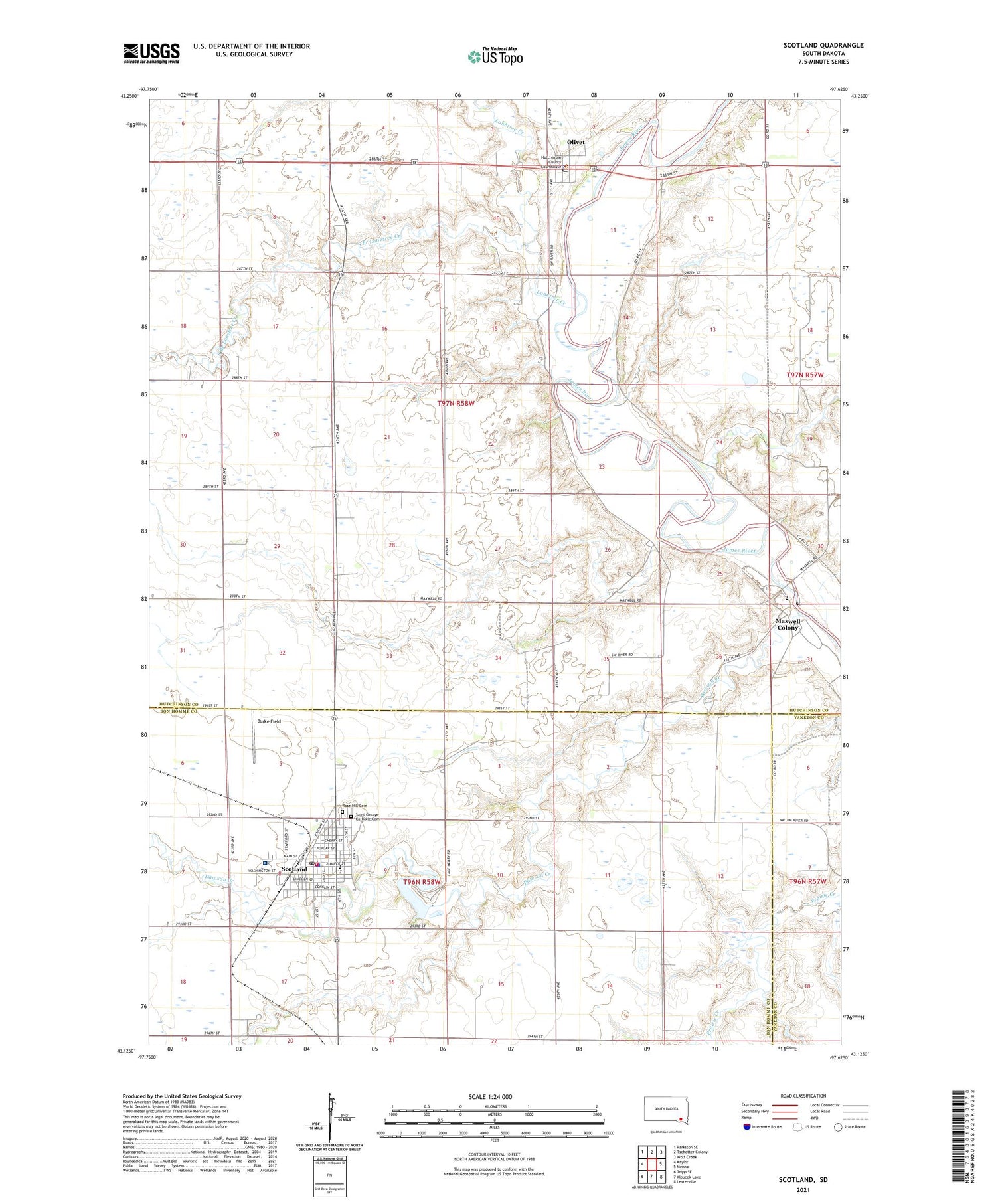
2021 topographic map quadrangle Scotland in the state of South Dakota. Scale: 1:24000. Based on the newly updated USGS 7.5' US Topo map series, this map is in the following counties: Hutchinson, Bon Homme, Yankton. The map contains contour data, water features, and other items you are used to seeing on USGS maps, but also has updated roads and other features. This is the next generation of topographic maps. Printed on high-quality waterproof paper with UV fade-resistant inks.
Quads adjacent to this one:
West: Kaylor
Northwest: Parkston SE
North: Tschetter Colony
Northeast: Wolf Creek
East: Menno
Southeast: Lesterville
South: Kloucek Lake
Southwest: Tripp SE
Contains the following named places: Burke Field, City of Scotland, Dawson Creek, Gunn School, Henry Dam, Hutchinson County Courthouse, Hutchinson County Sheriff's Office, Lake Henry, Lakeview School, Landmann - Jungman Memorial Hospital, Lonetree Creek, Mann School, Maxwell Colony, Maxwell Colony Census Designated Place, Maxwell Colony Elementary School, Olivet, Olivet Post Office, Rose Hill Cemetery, Saint George Catholic Cemetery, Schatz School, Scotland, Scotland City Hall, Scotland Community Ambulance Service, Scotland Community Library, Scotland Elementary School, Scotland Fire Department, Scotland High School, Scotland Middle School, Scotland Police Department, Scotland Post Office, South Branch Lonetree Creek, Town of Olivet, Township of Capital, Township of Olivet, Township of Scotland