
MyTopo
Silver City South Dakota US Topo Map
Couldn't load pickup availability
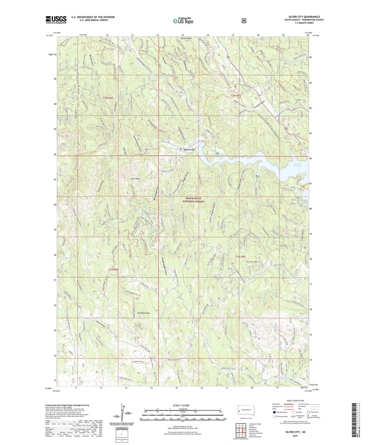
2021 topographic map quadrangle Silver City in the state of South Dakota. Scale: 1:24000. Based on the newly updated USGS 7.5' US Topo map series, this map is in the following counties: Pennington. The map contains contour data, water features, and other items you are used to seeing on USGS maps, but also has updated roads and other features. This is the next generation of topographic maps. Printed on high-quality waterproof paper with UV fade-resistant inks.
Quads adjacent to this one:
West: Rochford
Northwest: Minnesota Ridge
North: Nemo
Northeast: Piedmont
East: Pactola Dam
Southeast: Mount Rushmore
South: Hill City
Southwest: Medicine Mountain
Contains the following named places: Banner Gulch, Bear Gulch, Bear Gulch Campground, Bear Gulch II, Boarding House Gulch, Broad Gulch, Bullock Lookout Tower, California Gulch, Camp Prospect, Canyon City, Canyon Junction, Castle Creek, Clear Creek, Diana Mine, East Nugget Gulch, Elkhorn II, Empress Gulch, Fall Draw, Flannigan Cabin, Friday Gulch, Gold Dirt Mine, Golden Slipper Mine, Goose Pasture Draw, Gorman Gulch, Hay Draw, Homelode Mine, Horton Gulch, J and E Trailer Court, Jenney Gulch, Jenney Gulch Picnic Area, Jenney Mine, Kelly Gulch, Magpie Gulch, Merritt Peak, Middle Nugget Gulch, Nugget Gulch, Old Bald Peak, Omega Mine, Pactola Campground, Pactola Point Picnic Area, Pactola Reservoir, Pactola Reservoir Recreation Area, Pactola School, Post Draw, Queen Bee Mine, Rapid Creek Trail, Scruton Mountain, Silver City, Silver City Post Office, Silver City Volunteer Fire Department, Silver Peak, Skull Gulch, Slate Creek, Slate Creek Dam, Smoker Gulch, Spaw Gulch, Spruce Gulch, Spurgeon Gulch, Stewart Gulch, Sunbeam Mine, Sunnyside Gulch, Tiffel Mine, Tunnel Ridge, West Nugget Gulch, Whispering Pines Campground and Lodging


