MyTopo
Jones Tennessee US Topo Map
Couldn't load pickup availability
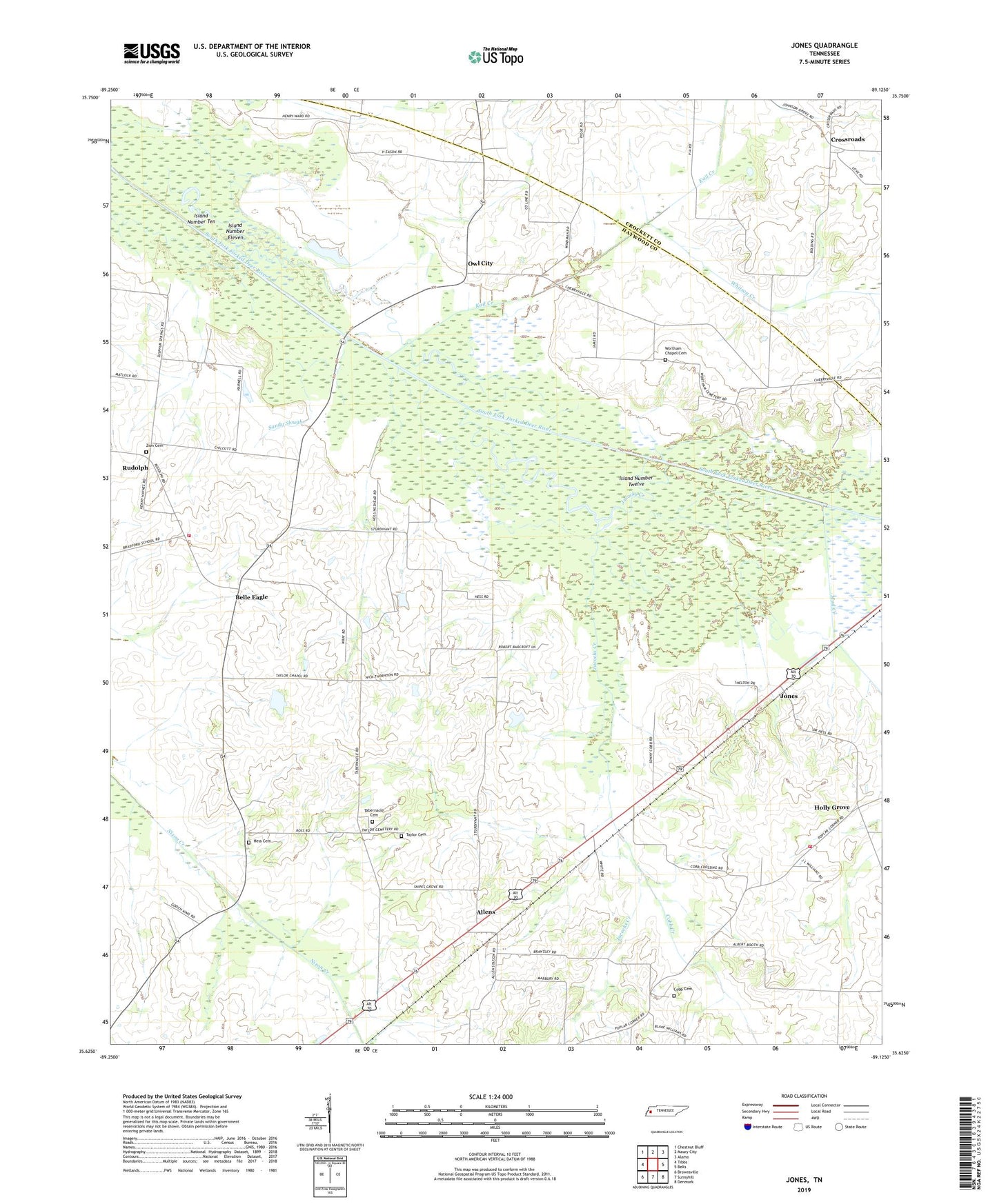
2022 topographic map quadrangle Jones in the state of Tennessee. Scale: 1:24000. Based on the newly updated USGS 7.5' US Topo map series, this map is in the following counties: Haywood, Crockett. The map contains contour data, water features, and other items you are used to seeing on USGS maps, but also has updated roads and other features. This is the next generation of topographic maps. Printed on high-quality waterproof paper with UV fade-resistant inks.
Quads adjacent to this one:
West: Tibbs
Northwest: Chestnut Bluff
North: Maury City
Northeast: Alamo
East: Bells
Southeast: Denmark
South: Sunnyhill
Southwest: Brownsville
This map covers the same area as the classic USGS quad with code o35089f2.
Contains the following named places: Allen Baptist Church, Allens, Antioch Baptist Church, Antioch School, Belle Eagle, Belle Eagle Church, Big Eddy, Bradford, Bradford School, Brownsville - Haywood County Fire Department District 7, Brownsville - Haywood County Fire Department District 8, Centerville School, Clark School, Cobb Cemetery, Cobb Creek, Commissioner District 2, Commissioner District 6, Cross Roads Baptist Church, Crossroads, Faith Church, Fort Ridge, Hess Cemetery, Hess School, Holly Grove, Holly Grove Baptist Church, Holly Grove School, Holly Grove-Belle Eagle Division, Hopewell School, Indian Head, Island Number Eleven, Island Number Ten, Island Number Twelve, Jacocks Creek, Jones, Kail Creek, Mud Creek, Owl City, Sanctified Church, Sandy Slough, Snipes Grove Church, Snipes Grove School, Tabernacle Cemetery, Tabernacle Church, Taylor Cemetery, Taylor Chapel, Taylor Chapel School, Thornton Airport, Threeway Church, Whitson Creek, William A Jameson Lake, William A Jameson Lake Dam, Wortham Chapel, Wortham Chapel Cemetery, Wortham Chapel School, Zion Cemetery, Zion Church