MyTopo
Claybrook Tennessee US Topo Map
Couldn't load pickup availability
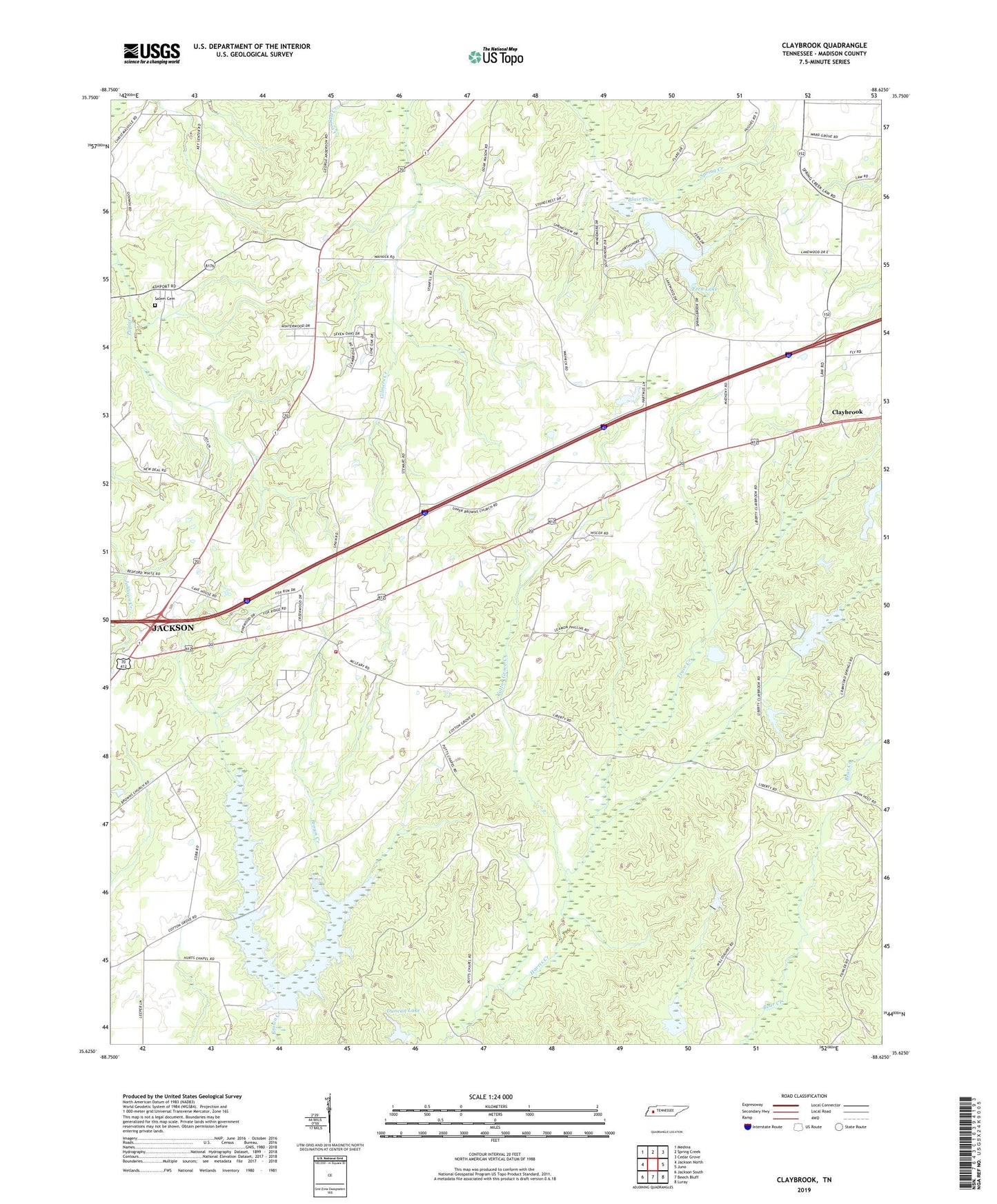
2022 topographic map quadrangle Claybrook in the state of Tennessee. Scale: 1:24000. Based on the newly updated USGS 7.5' US Topo map series, this map is in the following counties: Madison. The map contains contour data, water features, and other items you are used to seeing on USGS maps, but also has updated roads and other features. This is the next generation of topographic maps. Printed on high-quality waterproof paper with UV fade-resistant inks.
Quads adjacent to this one:
West: Jackson North
Northwest: Medina
North: Spring Creek
Northeast: Cedar Grove
East: Juno
Southeast: Luray
South: Beech Bluff
Southwest: Jackson South
This map covers the same area as the classic USGS quad with code o35088f6.
Contains the following named places: Blair Lake, Brown Church, Brown School, Center Point Church, Claybrook, Claybrook Church, Commissioner District 10, Cotton Grove, Cotton Grove Church, Cotton Grove Creek, Duncan Lake, Duncan Lake Dam, Fern Lake, Fern Lake Dam, Jones Creek, Liberty Church, Madison County Fire Department Station 12, Mount Carmel Church, OFDBA Dam Number 86-95-2, Old Carmel Church, Progress School, Salem Cemetery, Salem Church, Spring Creek-Beech Bluff Division, Springbrook Lake, Springbrook Lake Dam, Sunset Lake, Sunset Lake Dam, Trace Creek, Tri-Community School, Union Hill Church, WBBJ-TV (Jackson)