MyTopo
Juno Tennessee US Topo Map
Couldn't load pickup availability
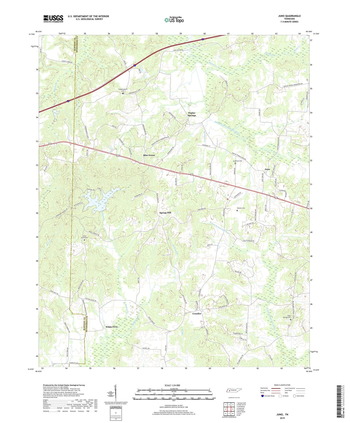
2022 topographic map quadrangle Juno in the state of Tennessee. Scale: 1:24000. Based on the newly updated USGS 7.5' US Topo map series, this map is in the following counties: Henderson, Madison. The map contains contour data, water features, and other items you are used to seeing on USGS maps, but also has updated roads and other features. This is the next generation of topographic maps. Printed on high-quality waterproof paper with UV fade-resistant inks.
Quads adjacent to this one:
West: Claybrook
Northwest: Spring Creek
North: Cedar Grove
Northeast: Clarksburg
East: Lexington
Southeast: Life
South: Luray
Southwest: Beech Bluff
This map covers the same area as the classic USGS quad with code o35088f5.
Contains the following named places: Anderson Cemetery, Atkins, Atkins Post Office, Beech Grove Church, Blue Goose, Claybrook School, Commissioner District 2, Cool Springs Church, Courtney Branch, Crucifer, Dry Branch, Dry School, Hamlet Cemetery, Henderson County Fire Department Station 1, Holly Springs Cemetery, Holly Springs Methodist Church, Holly Springs School, Independence, Independence Cemetery, Independence Church, Juno, Juno Church, Juno Post Office, Juno School, Maple Spring School, Maple Springs Church, McHaney Branch, Meals Creek, Mount Tabor Church, Nebo Church, Poplar Springs, Poplar Springs Methodist Church, Poplar Springs School, Providence School, Shady Grove Church, Spring Creek, Spring Hill, Union Grove Cemetery, Union Grove Church, Unity School, Wards Grove Church, Westover Elementary School, White Fern, WLJT-TV (Lexington)