MyTopo
Rockport Tennessee US Topo Map
Couldn't load pickup availability
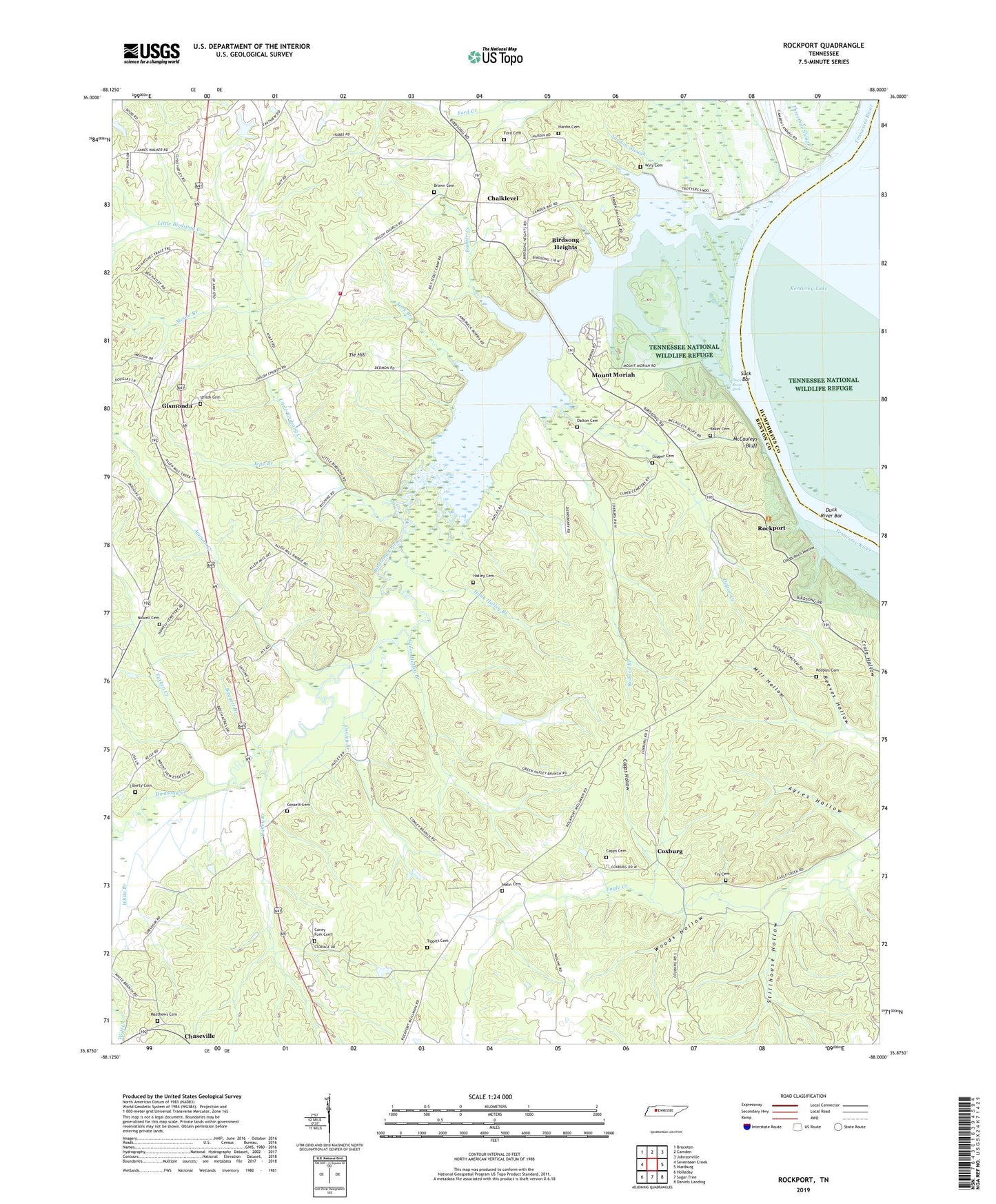
2022 topographic map quadrangle Rockport in the state of Tennessee. Scale: 1:24000. Based on the newly updated USGS 7.5' US Topo map series, this map is in the following counties: Benton, Humphreys. The map contains contour data, water features, and other items you are used to seeing on USGS maps, but also has updated roads and other features. This is the next generation of topographic maps. Printed on high-quality waterproof paper with UV fade-resistant inks.
Quads adjacent to this one:
West: Seventeen Creek
Northwest: Bruceton
North: Camden
Northeast: Johnsonville
East: Hustburg
Southeast: Daniels Landing
South: Sugar Tree
Southwest: Holladay
This map covers the same area as the classic USGS quad with code o35088h1.
Contains the following named places: Ammon Creek, Ayres Hollow, Badger Creek, Baggett Branch, Baker Cemetery, Ballard Branch, Birdsong Creek, Birdsong Dock and Resort, Birdsong Drive-In, Birdsong Heights, Brown Cemetery, Camps School, Caney Branch, Caney Fork Cemetery, Capps Cemetery, Capps Hollow, Center Hill Community Center, Center Hill School, Chalk Level Baptist Church, Chalk Level School, Chalk Level Volunteer Fire Department Station 1, Chalklevel, Chaseville, Coldbranch Hollow, Commissioner District 1, Conley Branch, Cooleys Landing, Coon Creek, Coxburg, Crockets Landing, Dalton Cemetery, Dalton Creek, Datrallo landing, Duck River Bar, Duck River Suck, Fairview School, Flowers Chapel, Ford Cemetery, Fry Cemetery, Gismonda, Gossett Cemetery, Gossetts Landing, Green Hatley Branch, Green Hill Baptist Church, Green Hill School, Hardin Cemetery, Hardin Store, Hatley Cemetery, Hauk Hatley Branch, Holladay Division, Jepp Branch, Liberty Cemetery, Little Birdsong Creek, Little Island, Lupper Cemetery, Malin Cemetery, Matthews Cemetery, McCauleys Bluff, McCauleys Bluff Landing, Mill Hollow, Moore Branch, Moore Chute, Mount Moriah, Mount Moriah Cumberland Presbyterian Church, Mount Moriah School, Nowell Cemetery, Peebles Cemetery, Reeves Hollow, Rockport, Rockport Landing, Russell Field Lookout Tower, Shiloh Baptist Church, Shiloh Cemetery, Stillhouse Hollow, Suck Bar, Thompsons Point Landing, Tie Hill, Tie Hill School, Tippitt Cemetery, Trotters Ferry, Trotters Landing, Turkey Creek, West Tennessee Boy Scout Camp, White Branch, Wildlife Cove Village, Woods Hollow, Wyly Cemetery, York Branch, Young Farmers and Homemakers Camp, ZIP Code: 38341