MyTopo
McConnell Tennessee US Topo Map
Couldn't load pickup availability
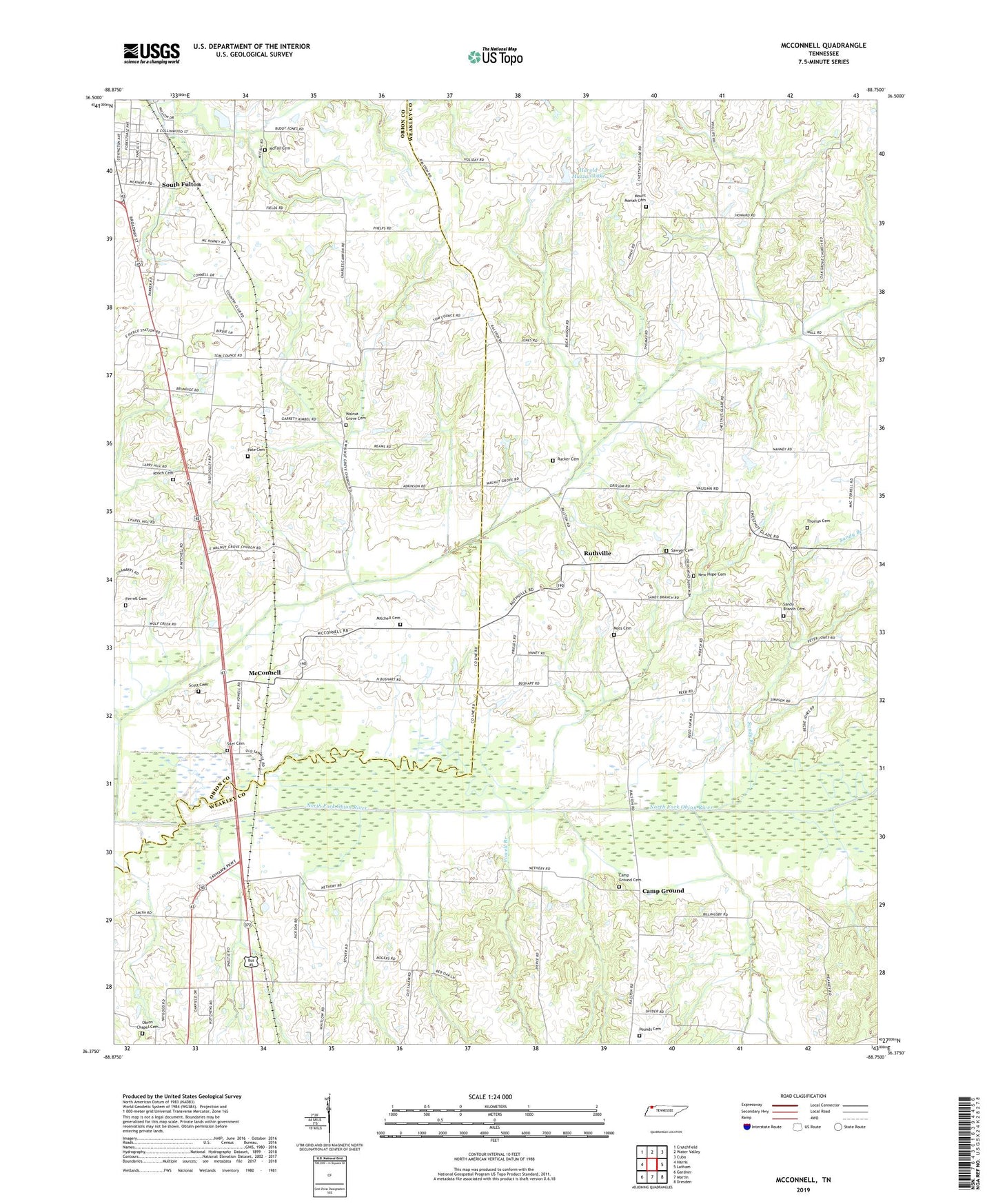
2019 topographic map quadrangle McConnell in the state of Tennessee. Scale: 1:24000. Based on the newly updated USGS 7.5' US Topo map series, this map is in the following counties: Weakley, Obion. The map contains contour data, water features, and other items you are used to seeing on USGS maps, but also has updated roads and other features. This is the next generation of topographic maps. Printed on high-quality waterproof paper with UV fade-resistant inks.
Quads adjacent to this one:
West: Harris
Northwest: Crutchfield
North: Water Valley
Northeast: Cuba
East: Latham
Southeast: Dresden
South: Martin
Southwest: Gardner
Contains the following named places: Camp Ground, Camp Ground Cemetery, Camp Ground Creek, Chestnut Glade, Chestnut Glade School, Commissioner District 8, Cypress Creek, Ferrell Cemetery, Harold Muzzall Dam, Harold Muzzall Lake, Hatlers Camp Ground Methodist Church, Jones Branch, Jones Creek, McConnell, McConnell Baptist Church, McFall Cemetery, Mitchell Cemetery, Moss Cemetery, Mount Moriah Cemetery, Mount Moriah Church, New Hope Baptist Church, New Hope Cemetery, Obion Chapel, Obion Chapel Cemetery, Parish School, Pate Cemetery, Pounds Cemetery, Roach Cemetery, Rucker Cemetery, Ruthville, Ruthville Baptist Church, Sandy Branch, Sandy Branch Cemetery, Sandy Branch Church, Sandy Branch School, Sawyer Cemetery, Scott Cemetery, Siler Cemetery, South Fulton Baptist Church, South Fulton Elementary School, Thomas Cemetery, Tommy Creek, Trouble Creek, Vowell Branch, Walnut Grove Branch, Walnut Grove Cemetery, Walnut Grove Church, Wolf Creek