MyTopo
Spring Creek Tennessee US Topo Map
Couldn't load pickup availability
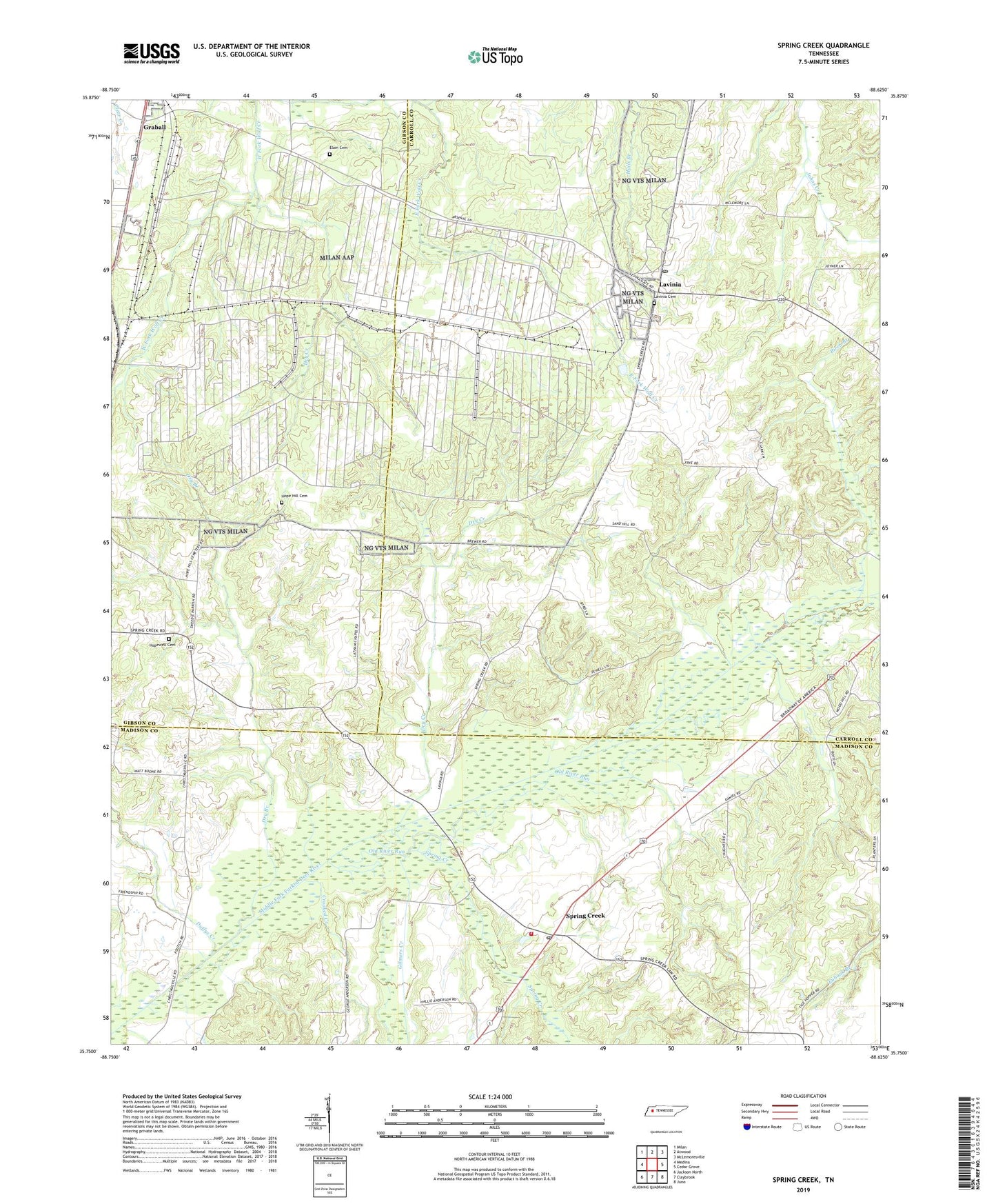
2022 topographic map quadrangle Spring Creek in the state of Tennessee. Scale: 1:24000. Based on the newly updated USGS 7.5' US Topo map series, this map is in the following counties: Carroll, Madison, Gibson. The map contains contour data, water features, and other items you are used to seeing on USGS maps, but also has updated roads and other features. This is the next generation of topographic maps. Printed on high-quality waterproof paper with UV fade-resistant inks.
Quads adjacent to this one:
West: Medina
Northwest: Milan
North: Atwood
Northeast: McLemoresville
East: Cedar Grove
Southeast: Juno
South: Claybrook
Southwest: Jackson North
This map covers the same area as the classic USGS quad with code o35088g6.
Contains the following named places: Bellwood School, Birch Branch, Crooked Creek, District 1, Dry Branch, Dry Creek, Duffys Creek, Elam Cemetery, Gilmers Creek, Graball, Hope Hill Cemetery, Hope Hill Church, Hope Hill School, Hopewell Cemetery, Hopewell Church, Lake Site Number 86-2, Latham Chapel, Lavinia, Lavinia Baptist Church, Lavinia Cemetery, Lavinia Census Designated Place, Lavinia Methodist Church, Lavinia Post Office, Madison County Fire Department Station 7, New Carmel Church, OFDBA Number 86-2 Dam, Old River Run, Spring Creek, Spring Creek Baptist Church, Spring Creek Post Office, Spring Creek School, Strayhorn School, Sunset View Church, West Carroll Primary School, West Plains Church, ZIP Code: 38348