MyTopo
Palmer Shelter Tennessee US Topo Map
Couldn't load pickup availability
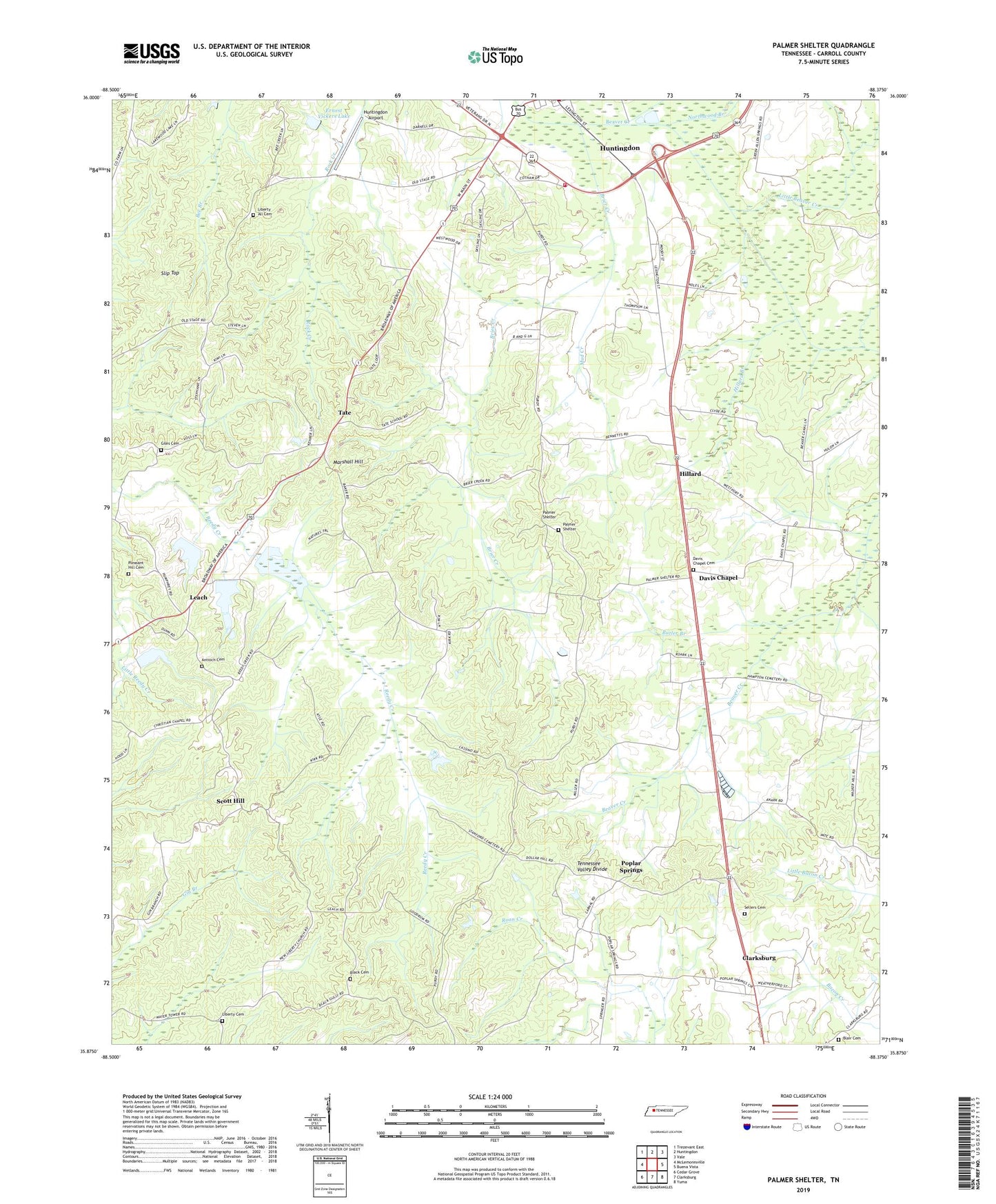
2022 topographic map quadrangle Palmer Shelter in the state of Tennessee. Scale: 1:24000. Based on the newly updated USGS 7.5' US Topo map series, this map is in the following counties: Carroll. The map contains contour data, water features, and other items you are used to seeing on USGS maps, but also has updated roads and other features. This is the next generation of topographic maps. Printed on high-quality waterproof paper with UV fade-resistant inks.
Quads adjacent to this one:
West: McLemoresville
Northwest: Trezevant East
North: Huntingdon
Northeast: Vale
East: Buena Vista
Southeast: Yuma
South: Clarksburg
Southwest: Cedar Grove
This map covers the same area as the classic USGS quad with code o35088h4.
Contains the following named places: Anark, Anark Church, Anark School, Antioch Cemetery, Black Cemetery, Blair Cemetery, Brier Creek, Butler Branch, Carroll County, Carroll County Rural Fire Department District 1 Huntingdon, Commissioner District 7, Davis Chapel, Davis Chapel Cemetery, District 12, Ernest Vickers Dam, Ernest Vickers Lake, Giles Cemetery, Hillard, Hillard Branch, Hillard School, Huntingdon Airport, Huntingdon Fire Department, Huntingdon First Baptist Church, Lakewood, Leach, Liberty All Cemetery, Liberty All Church, Liberty Baptist Church, Liberty Cemetery, Little Beaver Creek, Marshall Hill, Mud Creek, Northwood Branch, Palmer Shelter, Palmer Shelter Cemetery, Palmer Shelter United Methodist Church, Pleasant Hill Cemetery, Pleasant Hill Church, Pleasant Hill School, Poplar Springs, Poplar Springs Church of Christ, Poplar Springs School, Scott Hill, Scott Hill School, Sellers Hill Cemetery, Slip Top, Tate, Tate School, WPBE-FM (Huntingdon), ZIP Code: 38344