MyTopo
Yuma Tennessee US Topo Map
Couldn't load pickup availability
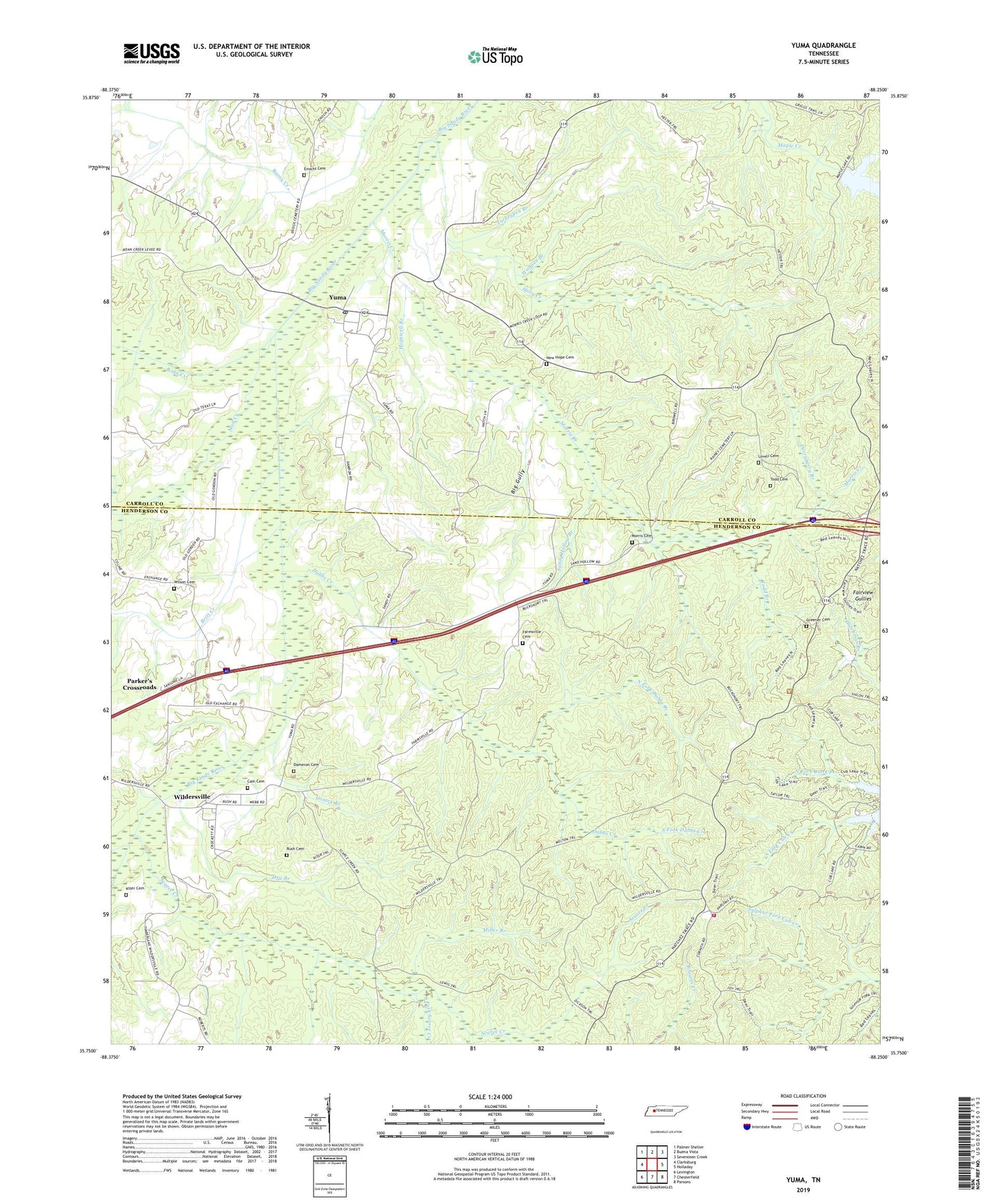
2022 topographic map quadrangle Yuma in the state of Tennessee. Scale: 1:24000. Based on the newly updated USGS 7.5' US Topo map series, this map is in the following counties: Henderson, Carroll. The map contains contour data, water features, and other items you are used to seeing on USGS maps, but also has updated roads and other features. This is the next generation of topographic maps. Printed on high-quality waterproof paper with UV fade-resistant inks.
Quads adjacent to this one:
West: Clarksburg
Northwest: Palmer Shelter
North: Buena Vista
Northeast: Seventeen Creek
East: Holladay
Southeast: Parsons
South: Chesterfield
Southwest: Lexington
This map covers the same area as the classic USGS quad with code o35088g3.
Contains the following named places: Belgrade School, Big Gully, Britt Creek, Burch School, Cain Cemetery, Cozark Branch, Cub Creek Lake, Dabbs Creek, Dameron Cemetery, Derryberry Branch, District 14, Dry Branch, Enochs Cemetery, Fairview Gullies, Farmsville School, Farmville, Farmville Cemetery, Greener Cemetery, Holly Springs Church, Hopewell Branch, Hopewell Church, Hopwell School, Horn Creek, Kizer Cemetery, Lovell Cemetery, Maple Creek Dam, Miller Branch, Morgan, Morris Cemetery, Morris Creek, Mount Pisgah Church, Mud Creek, Natchez Trace State Forest, Natchez Trace State Resort Park, New Hope Baptist Church, New Hope Cemetery, North Fork Dabbs Creek, Pleasant Exchange, Roan Creek, Rush Cemetery, Sandy Hollow Branch, Scarce Creek, South Fork Dabbs Creek, South Fork Scarce Creek, Sulphur Fork Trail, Tennessee Department of Agriculture Division of Forestry Natchez Trace, Todd Branch, Todd Cemetery, Turkeypen Branch, Wildersville, Wildersville Baptist Church, Wildersville Census Designated Place, Wildersville School, Wilson Cemetery, Wolfpen Branch, Yuma, Yuma Census Designated Place, Yuma Post Office, Yuma School, ZIP Codes: 38387, 38388, 38390