MyTopo
Pennine Tennessee US Topo Map
Couldn't load pickup availability
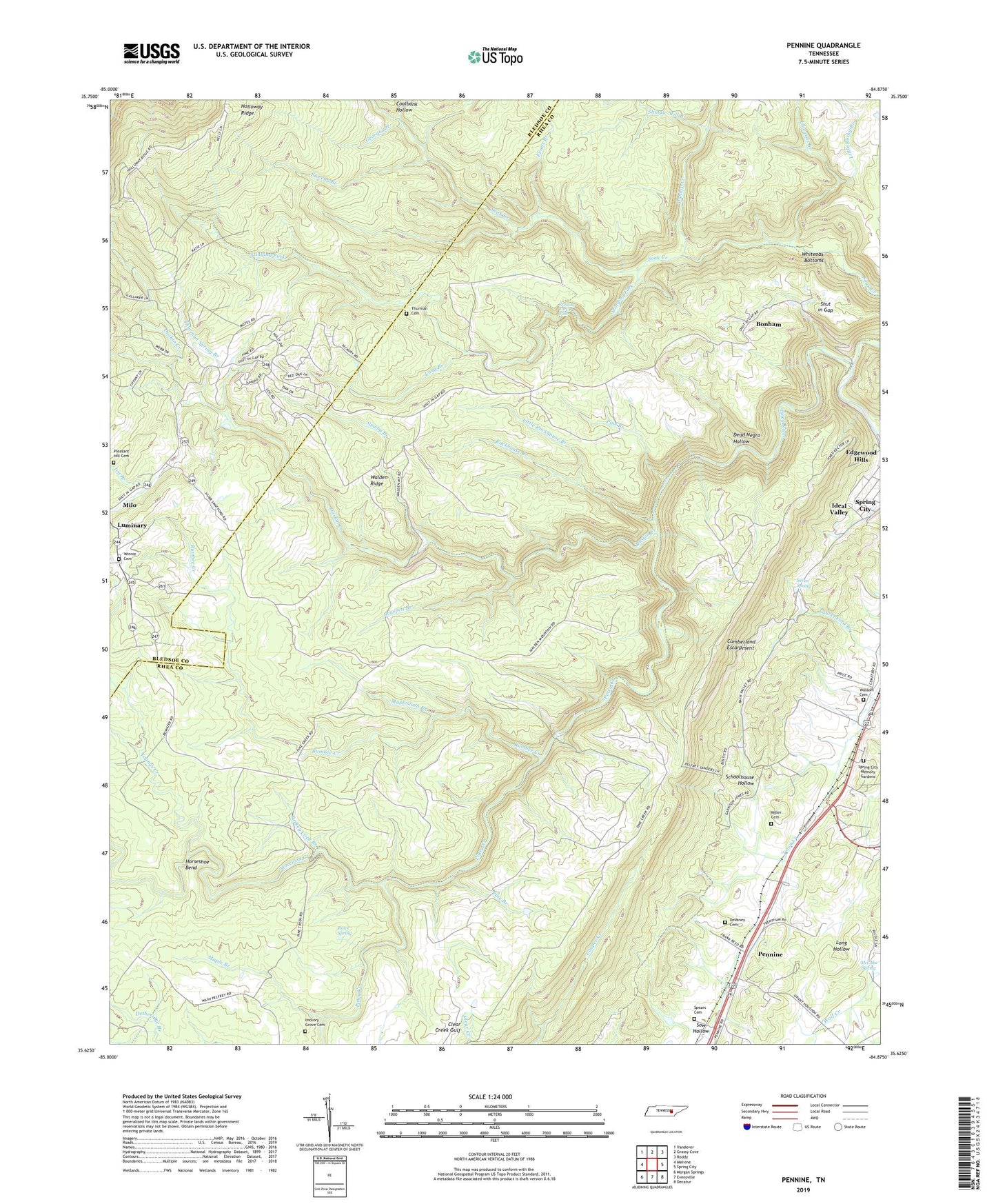
2022 topographic map quadrangle Pennine in the state of Tennessee. Scale: 1:24000. Based on the newly updated USGS 7.5' US Topo map series, this map is in the following counties: Rhea, Bledsoe. The map contains contour data, water features, and other items you are used to seeing on USGS maps, but also has updated roads and other features. This is the next generation of topographic maps. Printed on high-quality waterproof paper with UV fade-resistant inks.
Quads adjacent to this one:
West: Melvine
Northwest: Vandever
North: Grassy Cove
Northeast: Roddy
East: Spring City
Southeast: Decatur
South: Evensville
Southwest: Morgan Springs
This map covers the same area as the classic USGS quad with code o35084f8.
Contains the following named places: Bearpen Branch, Bonham, Bonham Hollow, Bonham School, Bonneville, Bumbee Creek, Coalbank Hollow, Commissioner District 2, DeVaney Cemetery, Dunlap Creek, Duskin Creek, Edgewood Hills, Edwards Branch, Evans Branch, Garrison Spring Branch, Georgia Branch, Hickory Grove Cemetery, Hickory Grove School, Horseshoe Bend, Ideal Valley, Ivy Branch, Kirkwood Number One Mine, Little Rockhouse Branch, Little Rocky Branch, Little Soak Creek, Long Branch, Luminary School, Maple Branch, Mapleslush Branch, McCabe Spring, Miller Cemetery, Milo, Moccasin Creek, Mountain View Church, Newby Branch, Norris Number One Mine, Pennine, Pennine Baptist Church, Pennine Post Office, Pine Branch, Piney Creek, Pleasant Hill Cemetery, Rector Mine, Rockhouse Branch, Rocky Creek Number Six Mine, Rowe Spring, Schoolhouse Hollow, Seven Spring, Sheffield Church, Shingle Mill Branch, Shut in Gap, Soak Creek, Sow Hollow, Spears Cemetery, Spring City Memory Gardens, Stinging Fork, Stinging Fork Falls, Sweeny Branch, Thurman Cemetery, Thurman Spring Branch, Turkey Cock Branch, Walden Ridge, Wassom Cemetery, Webbs Chapel, Webbs Chapel School, Whiteoak Bottoms, Winnie Cemetery, WXQK-AM (Spring City), Youngs Creek, ZIP Code: 37381


