MyTopo
Evensville Tennessee US Topo Map
Couldn't load pickup availability
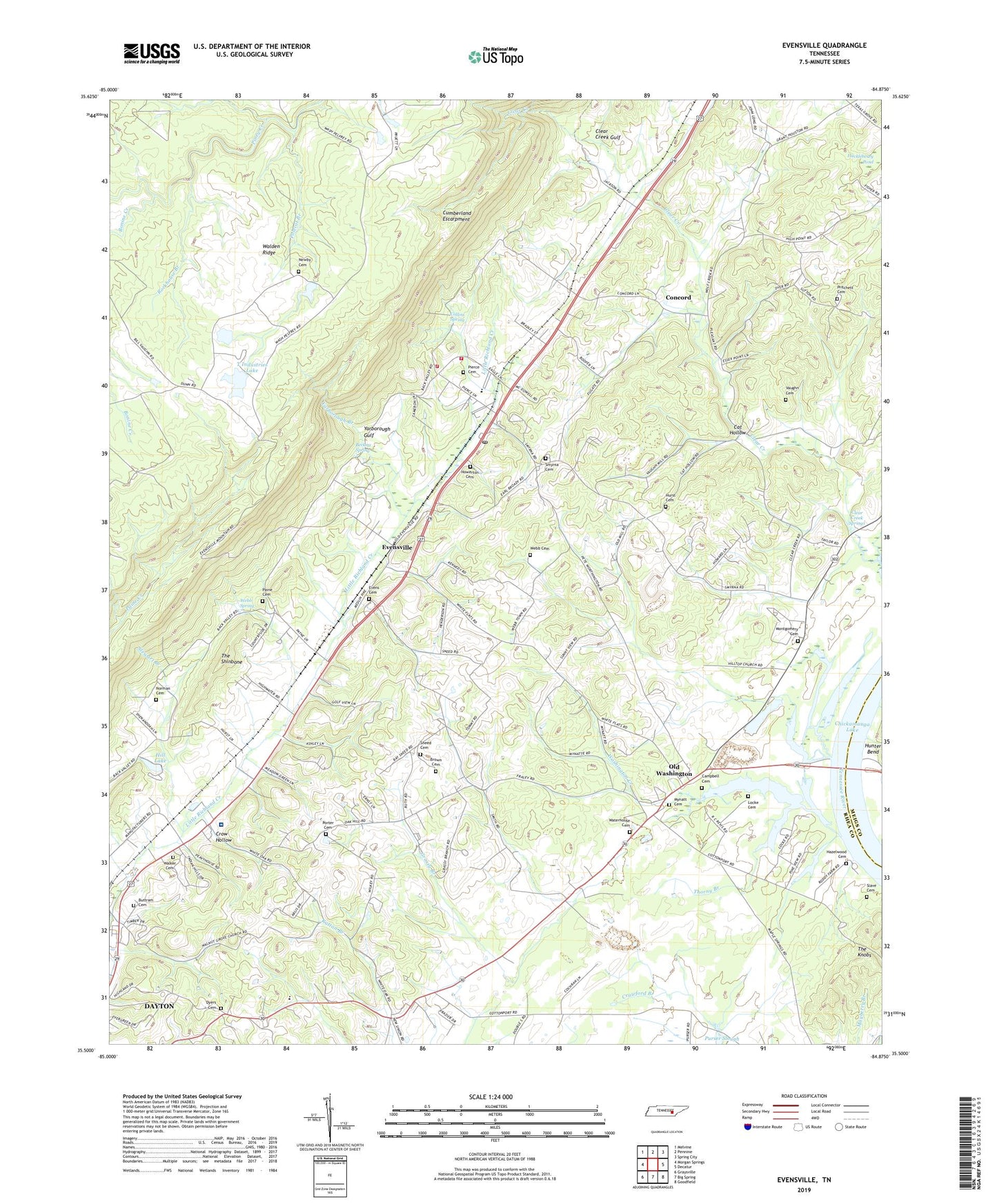
2022 topographic map quadrangle Evensville in the state of Tennessee. Scale: 1:24000. Based on the newly updated USGS 7.5' US Topo map series, this map is in the following counties: Rhea, Meigs. The map contains contour data, water features, and other items you are used to seeing on USGS maps, but also has updated roads and other features. This is the next generation of topographic maps. Printed on high-quality waterproof paper with UV fade-resistant inks.
Quads adjacent to this one:
West: Morgan Springs
Northwest: Melvine
North: Pennine
Northeast: Spring City
East: Decatur
Southeast: Goodfield
South: Big Spring
Southwest: Graysville
This map covers the same area as the classic USGS quad with code o35084e8.
Contains the following named places: Beckett Spring, Bonine Creek, Brown Cemetery, Buttram Cemetery, Campbell Cemetery, Cat Hollow, City of Dayton - Rhea County Landfill, Clear Creek Church, Clear Creek Gulf, Clear Creek Mill, Clear Creek School, Clear Creek Springs, Collins Spring, Commissioner District 3, Commissioner District 4, Concord, Concord School, Cooper Creek, Crow Hollow, Dayton Golf and Country Club, Detheridge Branch, Dyers Cemetery, Evens Cemetery, Evensville, Evensville Elementary School, Evensville Mine, Evensville Post Office, Goat Knob School, Grassy Branch, Hazel Ridge Shoals, Hazelrigs Ferry, Hazelwood Cemetery, High Point Church, Hill Lake, Howerton Cemetery, Huckleberry Pond, Hurst Cemetery, Kelly Grove Church, Kelly Grove School, Lake Hill Dam, Locke Cemetery, Maple Springs Church, Monmouth Presbyterian Church, Montgomery Cemetery, Mynatt Cemetery, Newby Cemetery, Norman Cemetery, Norman Chapel, Norman Chapel School, Oak Hill Church, Oak Hill School, Old Washington, Paine Cemetery, Pierce Cemetery, Pleasant Dale Church, Pleasant Dale School, Polecat Branch, Porter Cemetery, Pritchett Cemetery, Rhea County, Rhea County Ambulance Service, Rhea County Fire Department, Rhea County Fire Department Station 745 Evensville Fire District, Rhea County High School, Rhea Medical Center, Robinson Landing, Rockhouse Branch, Saint Bridget Church, Sentinel Heights, Slave Cemetery, Smyrna Cemetery, Smyrna Church, Smyrna Lookout Tower, Smyrna School, Sneed Cemetery, Stewart Branch, T Industries Lake, T Industries Lake Dam, The Knobs, The Shinbone, Thorny Branch, Valley Grove Church, Valley School, Vaughn Cemetery, Vaughn School, Walker Cemetery, Walnut Grove Church, Walnut Grove School, Washington Baptist Church, Washington Creek, Washington Ferry, Washington Landing, Washington School, Waterhouse Cemetery, Webb Cemetery, Webb Spring, White Oak Church, Yarborough Branch, Yarborough Gulf, ZIP Code: 37332