MyTopo
Poplar Creek Tennessee US Topo Map
Couldn't load pickup availability
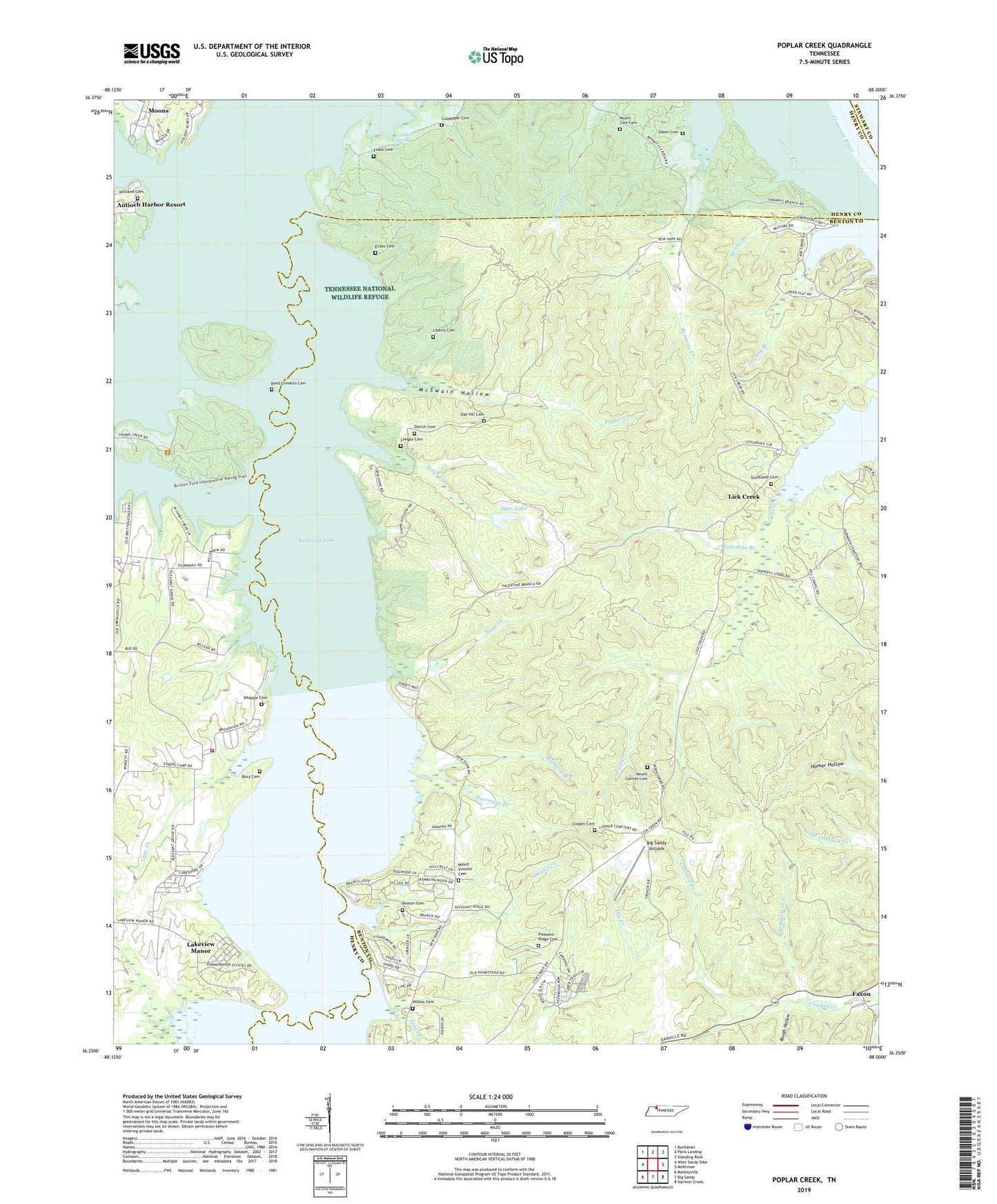
2022 topographic map quadrangle Poplar Creek in the state of Tennessee. Scale: 1:24000. Based on the newly updated USGS 7.5' US Topo map series, this map is in the following counties: Benton, Henry, Stewart. The map contains contour data, water features, and other items you are used to seeing on USGS maps, but also has updated roads and other features. This is the next generation of topographic maps. Printed on high-quality waterproof paper with UV fade-resistant inks.
Quads adjacent to this one:
West: West Sandy Dike
Northwest: Buchanan
North: Paris Landing
Northeast: Standing Rock
East: McKinnon
Southeast: Harmon Creek
South: Big Sandy
Southwest: Manleyville
This map covers the same area as the classic USGS quad with code o36088c1.
Contains the following named places: Antioch Boat Harbor, Beaton Cemetery, Bg Sandy River Drainage Ditch, Big Sandy Airpark, Bond-Limekiln Cemetery, Bucy Cemetery, Campbell Grove School, Cane Creek, Clendenin Creek, Commissioner District 6, Cooper Cemetery, County Junction Resort, Culpepper Cemetery, Daniel Creek, Dortch Cemetery, Dyer Lake, Dyer Lake Dam, Evans Cemetery, Evans Chapel, Faxon, Faxon Church, Granny Branch, Grannys Branch Dock, Hill Chapel, Hope Creek, Hurricane Branch, Iron Bridge Landing, Jones Creek, Lakeview Manor, Lashlee Spring, Leatherwood Island, Leegan Cemetery, Liberty Cemetery, Lick Creek, Lick Creek Landing, Lick Creek Methodist Church, Mansard Island Resort, Matheny Branch, McSwain Hollow, Moons, Mount Carmel Cemetery, Mount Carmel Church, Mount Vincent Cemetery, Mount Vincent Church, Mount Zion Cemetery, Mount Zion Church, Murphy Landing, New Hope Church, New Hope Landing, New Hope School, Noah Chapel, Oak Hill Cemetery, Oak Hill Church, Odem School, Odom Cemetery, Pleasant Grove Church, Pleasant Grove School, Pleasant Ridge Cemetery, Pleasant Ridge Church, Pleasant Ridge School, Poplar Creek, Redwater Creek, Rough Hollow, Snows Camp Dock, Sorrells Dock, Spring Branch, Springville Volunteer Fire Department Station 1, Stockdale Cemetery, Sulphur Well Landing, Trace Creek, Valentine Branch, West Sandy Creek, West Sandy Landing, Whipple Cemetery, Williams Cemetery, Willow Cemetery, Winter School, Wynes Ferry