MyTopo
Sango Tennessee US Topo Map
Couldn't load pickup availability
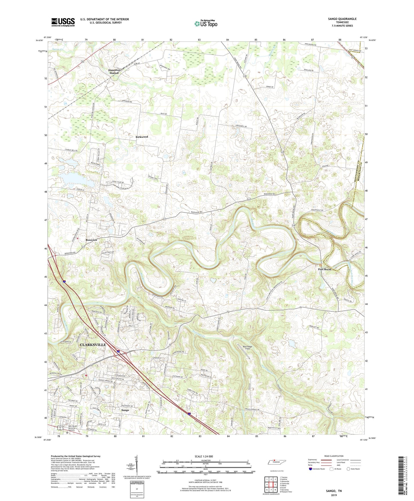
2022 topographic map quadrangle Sango in the state of Tennessee. Scale: 1:24000. Based on the newly updated USGS 7.5' US Topo map series, this map is in the following counties: Montgomery, Robertson. The map contains contour data, water features, and other items you are used to seeing on USGS maps, but also has updated roads and other features. This is the next generation of topographic maps. Printed on high-quality waterproof paper with UV fade-resistant inks.
Quads adjacent to this one:
West: Clarksville
Northwest: Trenton
North: Guthrie
Northeast: Allensville
East: Adams
Southeast: Pleasant View
South: Henrietta
Southwest: Excell
This map covers the same area as the classic USGS quad with code o36087e2.
Contains the following named places: Blue Ridge Field, Clarksville Baptist College, Clarksville Fire Rescue Department Station 2, Commissioner District 15, Commissioner District 19, Coon Creek, Corinth Church, Countryside Estates, District 1, District 5, Hampton Station, Hollins Chapel, Kirkwood, Kirkwood Baptist Church, Kirkwood School, Little Hope Church, Mount Nebo Church, Mount Zion Baptist Church, Nevel Chapel, Olive Church, Passenger Creek, Paula Heights, Pisgah School, Port Royal, Port Royal Church, Port Royal State Park, Red River Estates, Rossview, Rossview School, Royalty Acres, Saint Matthews Church, Sango, Sango School, Sulphur Fork Red River, Whites Chapel, Windermere