MyTopo
Seventeen Creek Tennessee US Topo Map
Couldn't load pickup availability
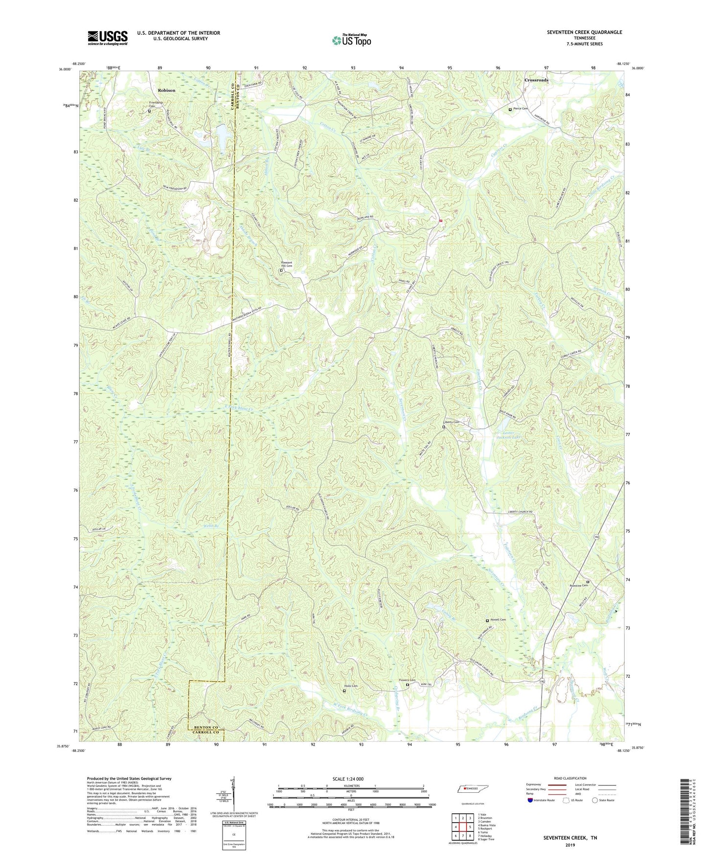
2022 topographic map quadrangle Seventeen Creek in the state of Tennessee. Scale: 1:24000. Based on the newly updated USGS 7.5' US Topo map series, this map is in the following counties: Benton, Carroll. The map contains contour data, water features, and other items you are used to seeing on USGS maps, but also has updated roads and other features. This is the next generation of topographic maps. Printed on high-quality waterproof paper with UV fade-resistant inks.
Quads adjacent to this one:
West: Buena Vista
Northwest: Vale
North: Bruceton
Northeast: Camden
East: Rockport
Southeast: Sugar Tree
South: Holladay
Southwest: Yuma
This map covers the same area as the classic USGS quad with code o35088h2.
Contains the following named places: Abbott Branch, Butler Church, Caney Branch, Carroll School, Chalk Level Volunteer Fire Department Station 2, Coldspring Branch, Cooper School, Cotton Creek Hunting Club Dam, Cotton Creek Hunting Club Lake, District 18, Divider School, East Fork Blunt Creek, Flowers Cemetery, Fourteen Creek, Garrett Cemetery, Hicks Cemetery, Lester Jackson Dam, Lester Jackson Lake, Liberty Cemetery, Liberty Church, Maple Creek, Mount Comfort Missionary Baptist Church, New Friendship Church, Nole School, Nowell Cemetery, Palestine Cemetery, Palestine Church, Pierce Cole Cemetery, Pleasant Hill, Pleasant Hill Baptist Church, Pleasant Hill Cemetery, Pleasant Hill School, Pond Branch, Pond Branch School, Robison, Sassafras Grove Church, Seventeen Creek, South Fork Blunt Creek, Sycamore Creek, Union Baptist Church, Walkers Store, Webb Branch, Whiteoak School, Wiley School, Wolf Creek, ZIP Code: 38318