MyTopo
Mac Bain Texas US Topo Map
Couldn't load pickup availability
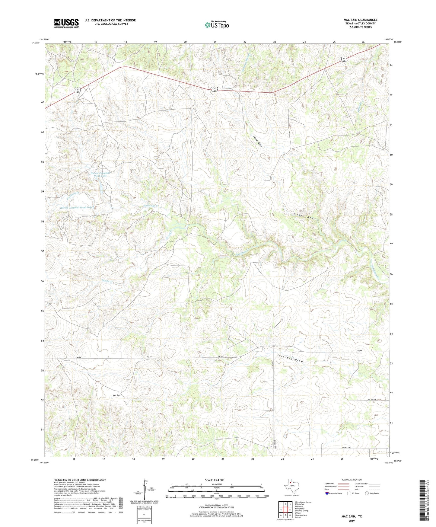
2022 topographic map quadrangle Mac Bain in the state of Texas. Scale: 1:24000. Based on the newly updated USGS 7.5' US Topo map series, this map is in the following counties: Motley. The map contains contour data, water features, and other items you are used to seeing on USGS maps, but also has updated roads and other features. This is the next generation of topographic maps. Printed on high-quality waterproof paper with UV fade-resistant inks.
Quads adjacent to this one:
West: Dougherty
Northwest: Dick Moore Canyon
North: Whiteflat
Northeast: Matador
East: Roaring Springs
Southeast: Afton
South: Rustler Camp
Southwest: Wake
Contains the following named places: Carter Draw, Harold Campbell North Lake, Harold Campbell North Lake Dam, Harold Campbell South Lake, Harold Campbell South Lake Dam, Mac Bain, Spring Creek, Wason Draw