MyTopo
Haystack Mountain Texas US Topo Map
Couldn't load pickup availability
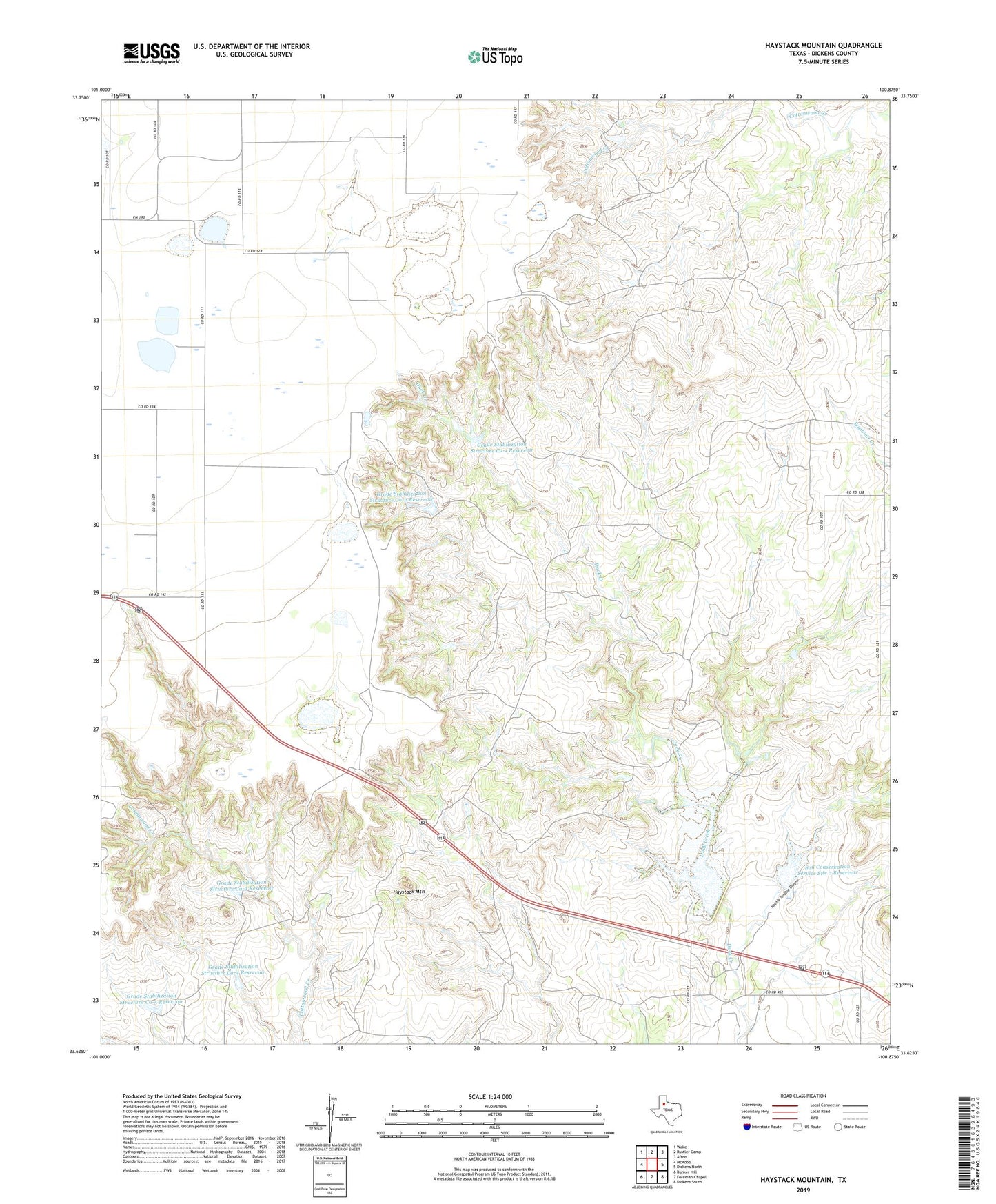
2022 topographic map quadrangle Haystack Mountain in the state of Texas. Scale: 1:24000. Based on the newly updated USGS 7.5' US Topo map series, this map is in the following counties: Dickens. The map contains contour data, water features, and other items you are used to seeing on USGS maps, but also has updated roads and other features. This is the next generation of topographic maps. Printed on high-quality waterproof paper with UV fade-resistant inks.
Quads adjacent to this one:
West: McAdoo
Northwest: Wake
North: Rustler Camp
Northeast: Afton
East: Dickens North
Southeast: Dickens South
South: Foreman Chapel
Southwest: Bunker Hill
This map covers the same area as the classic USGS quad with code o33100f8.
Contains the following named places: Grade Stabilization Structure Ca-1 Reservoir, Grade Stabilization Structure Ca-2 Reservoir, Grade Stabilization Structure Ca-3 Reservoir, Grade Stabilization Structure Ca-4 Reservoir, Grade Stabilization Structure Ca-5 Reservoir, Haystack Mountain, Hobble Scobble Canyon, Soil Conservation Service Lake 1, Soil Conservation Service Site 1 Dam, Soil Conservation Service Site 2 Dam, Soil Conservation Service Site 2 Reservoir, Soil Conservation Service Site Ca-1 Dam, Soil Conservation Service Site Ca-2 Dam, Soil Conservation Service Site Ca-3 Dam, Soil Conservation Service Site Ca-4 Dam, Soil Conservation Service Site Ca-5 Dam