MyTopo
New Salem Texas US Topo Map
Couldn't load pickup availability
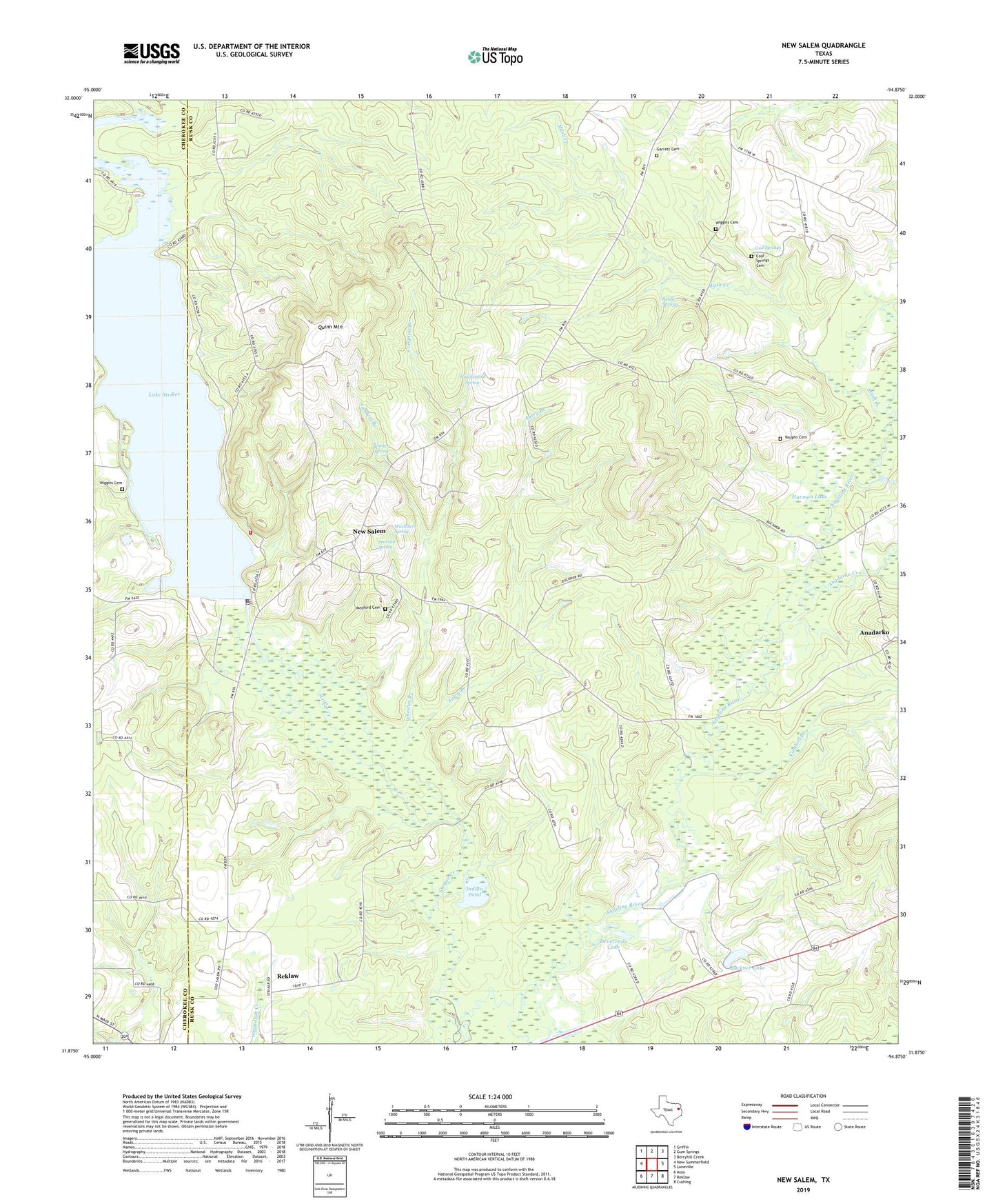
2022 topographic map quadrangle New Salem in the state of Texas. Scale: 1:24000. Based on the newly updated USGS 7.5' US Topo map series, this map is in the following counties: Rusk, Cherokee. The map contains contour data, water features, and other items you are used to seeing on USGS maps, but also has updated roads and other features. This is the next generation of topographic maps. Printed on high-quality waterproof paper with UV fade-resistant inks.
Quads adjacent to this one:
West: New Summerfield
Northwest: Griffin
North: Gum Springs
Northeast: Berryhill Creek
East: Laneville
Southeast: Cushing
South: Reklaw
Southwest: Atoy
This map covers the same area as the classic USGS quad with code o31094h8.
Contains the following named places: Anadarko, Anadarko Cemetery, Anadarko Creek, Autry Branch, Black Lake, Buckner Dam, Buckner Lake, Cambell Branch, Compton Branch, Cool Springs, Cool Springs Cemetery, Devereaux Lake, Fairview, Garrett Cemetery, Harmon Lake, Indian Pond, Johnson Lake, Lake Striker, Lake Striker Dam, Medford Cemetery, Miracle Church, Mush Creek, New Salem, New Salem Volunteer Fire Department, Pearson Spring, Post Oak Grove Church, Quinn Mountain, Riddle Springs, Sanders Branch, Skinner Spring, Striker Creek, Vaughn Cemetery, Washburn Spring, Weatherford Spring, Wheelus Branch, Wiggins Cemetery