MyTopo
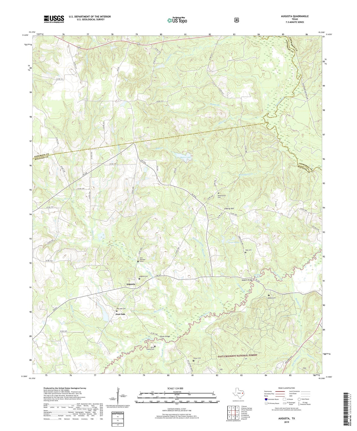
Augusta Texas US Topo Map
Couldn't load pickup availability
Also explore the Augusta Forest Service Topo of this same quad for updated USFS data
2022 topographic map quadrangle Augusta in the state of Texas. Scale: 1:24000. Based on the newly updated USGS 7.5' US Topo map series, this map is in the following counties: Houston, Anderson, Cherokee. The map contains contour data, water features, and other items you are used to seeing on USGS maps, but also has updated roads and other features. This is the next generation of topographic maps. Printed on high-quality waterproof paper with UV fade-resistant inks.
Quads adjacent to this one:
West: Percilla
Northwest: Slocum
North: Denson Springs
Northeast: Pryor Mountain
East: Weches
Southeast: Ratcliff
South: Crockett NE
Southwest: Grapeland
This map covers the same area as the classic USGS quad with code o31095e3.
Contains the following named places: Augusta, Augusta Cemetery, Augusta Community Christian Church, Augusta Male and Female Academy, Augusta School, Augusta Union Church, Austin Branch, Bobbitt Bridge, Bobbitt Cemetery, Bobbitt Lake, Bobbittville, Bodenhamer Cemetery, Bodenhamer Creek, Bodenhamer Ferry, Bowdenheimer Creek, Bracken Creek, Brewington Church, Butler Branch, Copperas Branch, Copperas Branch School, Davis Creek, Davis Family Cemetery, Glover, Glover Bridge, Glover Cemetery, Glover Church, Glover School, Grove Lakes, Hickory Hill Branch, Jenkins Chapel, John Sheridan Grave, Liberty Hill, Liberty Hill Church, Liberty Hill School, Maggie Branch, Miles Creek, Moore Branch, Moore Lake, Moore Lake Dam, Peter Branch, Pine Spring Creek, Pine Top Church, Post Oak, Post Oak Cemetery, Post Oak School, Rich Creek, Sheridan Branch, Silver Creek, Smith Creek, Story Branch, Wall Cemetery, Waneta