MyTopo
Austin East Texas US Topo Map
Couldn't load pickup availability
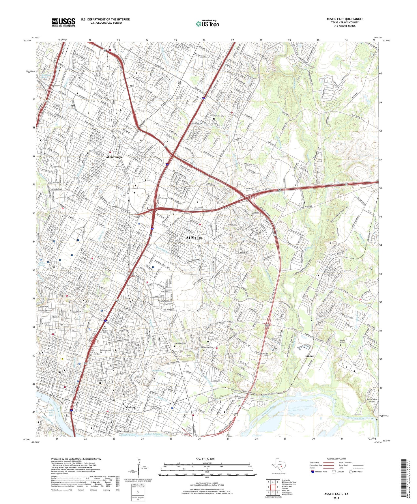
2022 topographic map quadrangle Austin East in the state of Texas. Scale: 1:24000. Based on the newly updated USGS 7.5' US Topo map series, this map is in the following counties: Travis. The map contains contour data, water features, and other items you are used to seeing on USGS maps, but also has updated roads and other features. This is the next generation of topographic maps. Printed on high-quality waterproof paper with UV fade-resistant inks.
Quads adjacent to this one:
West: Austin West
Northwest: Jollyville
North: Pflugerville West
Northeast: Pflugerville East
East: Manor
Southeast: Webberville
South: Montopolis
Southwest: Oak Hill
This map covers the same area as the classic USGS quad with code o30097c6.
Contains the following named places: Abercrombie, Adams Park, Alamo Park, Allan Elementary School, Allan Junior High School, American Institute for Learning High School, Anderson High School, Andrews School, Austin, Austin American Sleep Diagnostic Center, Austin High School, Austin Office of Rural Health, Austin State Hospital, Austin State Hospital Cemetery, Austin Women's Hospital, Bailey Park, Baker School, Bartholomew Park, Bethany Cemetery, Blackshear School, Blanton School, Blunn Creek, Boggy Creek, Boggy Creek Greenbelt Trail, Boggy Creek Park, Brackenridge Hospital Heliport, Bremond Block Historic District, Brentwood Park, Brentwood School, Brooke School, Brown School, Burr Field, Buttermilk Branch Greenbelt Trail, Campbell School, Capital Plaza Shopping Center, Capitol National Bank Building Heliport, Cathedral School of Saint Mary, Central Park Shopping Center, Central Texas Rehabilitation Hospital, Christopher House, City of Austin Electric Utility, Clark Field, Colony Park, Comal Park, Concordia College, Congress Avenue Historic District, Cornerstone Hospital of Austin, Crossroads Shopping Center, Daffan, Darrell K Royal Texas Memorial Stadium - University of Texas, Daughters of Saint Joseph School, Dell Children's Medical Center of Central Texas, Disability and Impairment Assessment Center, Disch-Falk Field - University of Texas, Downs Park, Dr Exalton and Wilhelmina Delco Activity Center, East Avenue Park, East Bouldin Creek, Eastland Plaza Shopping Center, Eastwoods Park, Evergreen Cemetery, Fascholz-Keller Baseball Complex, Ferguson Branch, Fiskville Cemetery, Frank Erwin Center - University of Texas, Givens Park, Govalle Playground, Govalle School, Govalle Shopping Center, Gullett School, Hal C Weaver Power Plant, Hancock Creek, Hancock Shopping Center, Harris School, HealthSouth Rehabilitation Hospital of Austin, Heart Hospital of Austin, Hemphill Park, Highland Shopping Center, Highland Village Shopping Center, Holly Street Power Plant, Holy Cross Hospital, House and Home Center Shopping Center, Huston Tillotson College, Hyde Park Historic District, Iglehart, Johnston High School, Jordan Park, Kealing Junior High School, Kealing Park, KFIT-AM (Lockhart), KFIT-AM (Sunset Valley), KFON-AM (Rollingwood), KMOW-AM (Austin), KTXZ-AM (West Lake Hills), La Frontera Shopping Center, Lady Bird Lake Hike and Bike Trail, Lamar Junior High School, Lanier Junior High School, Lee and Joe Jamail Texas Swimming Center - University of Texas, Lincoln Village Shopping Center, Little Walnut Creek, Longhorn Dam, Lott Park, Maplewood School, Maroon Stadium, McCallum High School, Metz Park, Metz School, Mike A Myers Track and Soccer Stadium - University of Texas, Moonlight Towers, Moore-Hancock Farmstead, Morris Williams Golf Course, Mount Calvary Cemetery, Mouse Park, Navarro Early College High School, Nelson Field, North Austin Optimist Baseball Field, North Park Sopping Center, North Village Shopping Center, Northcross Shopping Center, Northeast Park, Northwest District Park Trail, Northwest Park, Oak Spring, Oak Springs School, Oakwood Cemetery, Oakwood Cemetery Annex, Ortega School, Palm Playground, Palm School, Pan American Playground, Pasteur Institute, Patterson Park, Pearce School, Pease School, Pecan Springs Park, Pecan Springs School, Penick-Allison Tennis Center, Pershing, Plummers Cemetery, Quail Creek Park, Rainey Street Historic District, Ramsey Playground, Read School, Reagan School, Red and Charlie McCombs Field, Redeemer Lutheran School, Reilly School, Ridgetop School, Robbins Academy, Robert E Lee School, Robert Mueller Municipal Airport, Rogers Hill Cemetery, Rosedale Elementary School, Rosedale School, Rosewood Park, Rosewood School, Sacred Heart School, Sain Johns School, Saint Andrews School, Saint Austin Catholic School, Saint David's Day Surgery Center, Saint Davids Heliport, Saint David's Medical Center, Saint David's Occupational Health Services, Saint David's Pavilion, Saint Johns Park, Saint Louis School, Saint Marys Academy, Saint Pauls School, San Juan School, Sanchez Elementary School, Seabrook Park, Seiders Spring, Seton Hospital, Seton League House, Seton Medical Center Austin, Seton Medical Center H-4 Heliport, Seton Shoal Creek Hospital, Seton Southwest-Shivers Center, Shadow Lawn Historic District, Shipe Playground, Shoal Beach, Shoal Creek, Sims Elementary School, Sims School, Sixth Street Historic District, Smoot, Spicewood Spring, Springdale Park, Springdale Shopping Center, Sprinkle, Swedish Hill Historic District, Tannehill Branch, Texan Surgery Center, Texas Academy of Excellence, Texas Blind- Deaf and Orphan School, Texas Empowerment Academy, Texas Memorial Stadium, Texas School for the Blind, Texas State Cemetery, Texas State Mental Health and Mental Retardation Department, The Brown School, Travis State School, Trinity School, University Junior High School, University Medical Center Brackenridge, University of Texas, Waller Creek, Walnut Creek, Walnut Creek Nature Preserve, Walnut Creek Wastewater Treatment Plant, Walter Beach, Waterloo Park, Webb Middle School, West Anderson Plaza Shopping Center, Willow-Spence Streets Historic District, Winn Elementary School, Wooldridge Park, Wooldridge School, Wooten School, Zargosa Park, Zavala School, ZIP Codes: 78701, 78702, 78705, 78712, 78721, 78722, 78723, 78751, 78752, 78754, 78756, 78757


