MyTopo
Bartons Chapel Texas US Topo Map
Couldn't load pickup availability
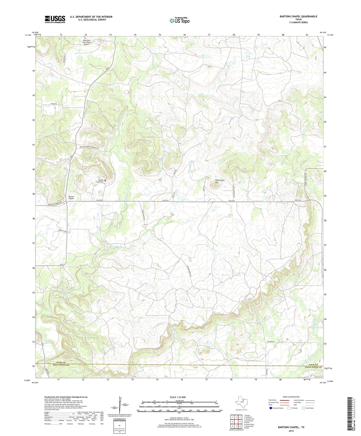
2019 topographic map quadrangle Bartons Chapel in the state of Texas. Scale: 1:24000. Based on the newly updated USGS 7.5' US Topo map series, this map is in the following counties: Jack, Palo Pinto. The map contains contour data, water features, and other items you are used to seeing on USGS maps, but also has updated roads and other features. This is the next generation of topographic maps. Printed on high-quality waterproof paper with UV fade-resistant inks.
Quads adjacent to this one:
West: Long Hollow
Northwest: Senate
North: Jacksboro
Northeast: Jacksboro NE
East: Perrin
Southeast: Whitt
South: Graford East
Southwest: Graford West
Contains the following named places: Bartons Chapel, Bartons Chapel Cemetery, Gladys Johnson Ritchie Public Library, Richards Lake, Richards Lake Dam, Salt Creek, Sparks Spring Church, Springdale Branch, Tettertiller Hill, Two Bush Branch