MyTopo
Batesville SW Texas US Topo Map
Couldn't load pickup availability
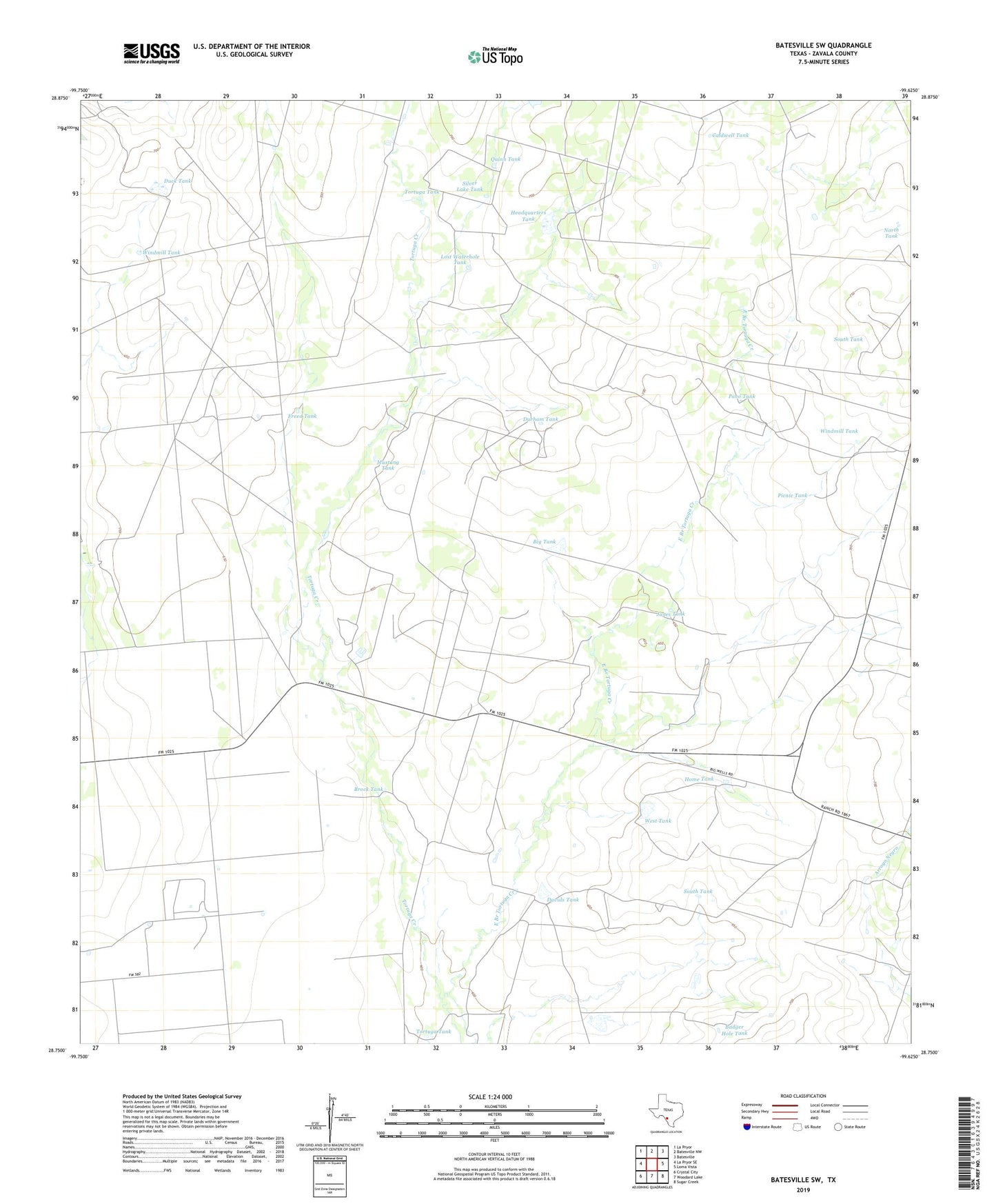
2022 topographic map quadrangle Batesville SW in the state of Texas. Scale: 1:24000. Based on the newly updated USGS 7.5' US Topo map series, this map is in the following counties: Zavala. The map contains contour data, water features, and other items you are used to seeing on USGS maps, but also has updated roads and other features. This is the next generation of topographic maps. Printed on high-quality waterproof paper with UV fade-resistant inks.
Quads adjacent to this one:
West: La Pryor SE
Northwest: La Pryor
North: Batesville NW
Northeast: Batesville
East: Loma Vista
Southeast: Sugar Creek
South: Woodard Lake
Southwest: Crystal City
This map covers the same area as the classic USGS quad with code o28099g6.
Contains the following named places: Badger Hole Tank, Big Tank, Brock Tank, Caldwell Tank, Cassin Dam, Cassin Tank, Davids Tank, Duck Tank, Durham Tank, East Branch Tortuga Creek, Freed Tank, Headquarters Tank, Home Tank, Jones Tank, Lost Waterhole Tank, Mustang Tank, North Tank, Pavo Tank, Picnic Tank, Quinn Tank, Silver Lake Tank, South Tank, Tortuga Tank, West Tank, Windmill Tank