MyTopo
Electra Texas US Topo Map
Couldn't load pickup availability
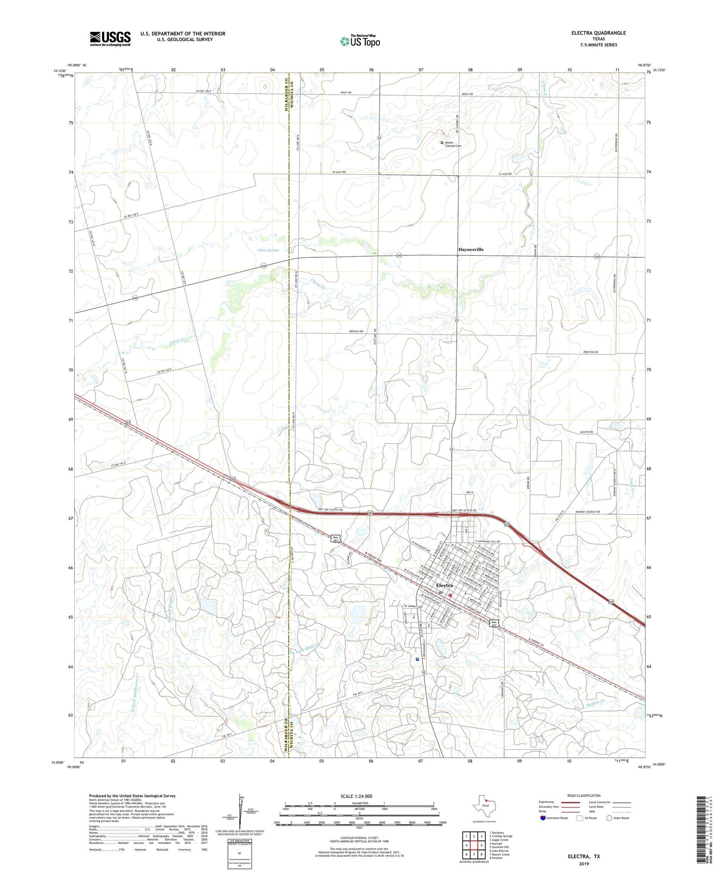
2022 topographic map quadrangle Electra in the state of Texas. Scale: 1:24000. Based on the newly updated USGS 7.5' US Topo map series, this map is in the following counties: Wichita, Wilbarger. The map contains contour data, water features, and other items you are used to seeing on USGS maps, but also has updated roads and other features. This is the next generation of topographic maps. Printed on high-quality waterproof paper with UV fade-resistant inks.
Quads adjacent to this one:
West: Harrold
Northwest: Davidson
North: Cowboy Springs
Northeast: Augar Creek
East: Sunshine Hill
Southeast: Fowlkes
South: Beaver Creek
Southwest: Lake Electra
This map covers the same area as the classic USGS quad with code o34098a8.
Contains the following named places: Bethel Baptist Church, China Springs, Church of Christ, City of Electra, Dinsmore Elementary School, Dinsmore School, Eastside Church of Christ, Electra, Electra City Hall, Electra City Park, Electra Community Church, Electra Fire Department, Electra High School, Electra Junior High School, Electra Memorial Hospital, Electra Police Department, Electra Post Office, Grand Theater, Haynesville, Hillside Baptist Church, KWFS-FM (Wichita Falls), KWTA-FM (Electra), KYYI-FM (Burkburnett), Mount Carmel Cemetery, Old Electra City Dam, Old Electra City Lake, United Pentecostal Church, Waggoner Estate Lake Number 1, Waggoner Estate Lake Number 1 Dam, Waggoner Ranch Lake Number 7, Waggoner Ranch Lake Number 7 Dam, Ward School, Wichita County Constable's Office Precinct 4, ZIP Code: 76364