MyTopo
Berryville Texas US Topo Map
Couldn't load pickup availability
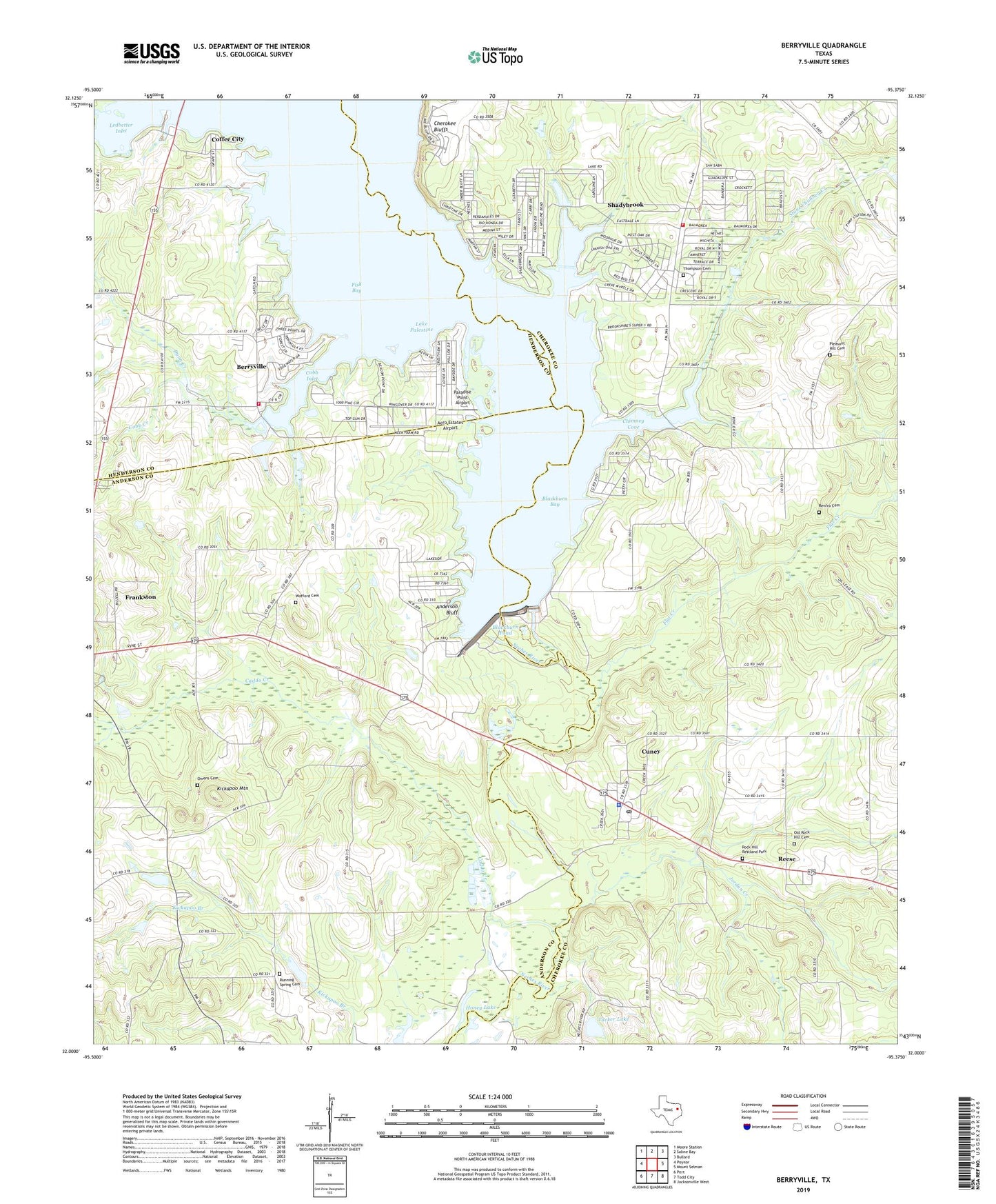
2019 topographic map quadrangle Berryville in the state of Texas. Scale: 1:24000. Based on the newly updated USGS 7.5' US Topo map series, this map is in the following counties: Cherokee, Anderson, Henderson. The map contains contour data, water features, and other items you are used to seeing on USGS maps, but also has updated roads and other features. This is the next generation of topographic maps. Printed on high-quality waterproof paper with UV fade-resistant inks.
Quads adjacent to this one:
West: Poynor
Northwest: Moore Station
North: Saline Bay
Northeast: Bullard
East: Mount Selman
Southeast: Jacksonville West
South: Todd City
Southwest: Pert
Contains the following named places: Aero Estates Airport, Anderson Bluff, Berryville, Berryville City Hall, Berryville Community Church, Berryville Volunteer Fire Department, Blackburn Bay, Blackburn Crossing Dam, Blackburn Pond, Caddo Creek, Caney Branch, Cherokee Bluffs, Cherokee Landing, Chimney Cove, Cobb Creek, Cobb Inlet, Coffee City, Corinth Church, Cuney, Cuney Police Department, Cuney Post Office, Dunn Creek, Fish Bay, Flat Creek, Hilltop Baptist Church, Honey Lake, Jordan Creek, Kickapoo Battlefield Monument, Kickapoo Mountain, Lake Palestine, Lake Palestine East Volunteer Fire Department, Ledbetter Bay, Ledbetter Creek, Ledbetter Inlet, Mount Olive Church, Old Rock Hill Cemetery, Owens Cemetery, Paradise Point Airport, Pleasant Hill Cemetery, Reese, Renfro Cemetery, Rock Hill Restland Park, Running Spring Cemetery, Shadybrook Census Designated Place, Stone Chimney Creek, Thompson Cemetery, Town of Berryville, Town of Cuney, Tucker Lake, Tucker Lake Dam, Wofford Cemetery, ZIP Code: 75759