MyTopo
Pert Texas US Topo Map
Couldn't load pickup availability
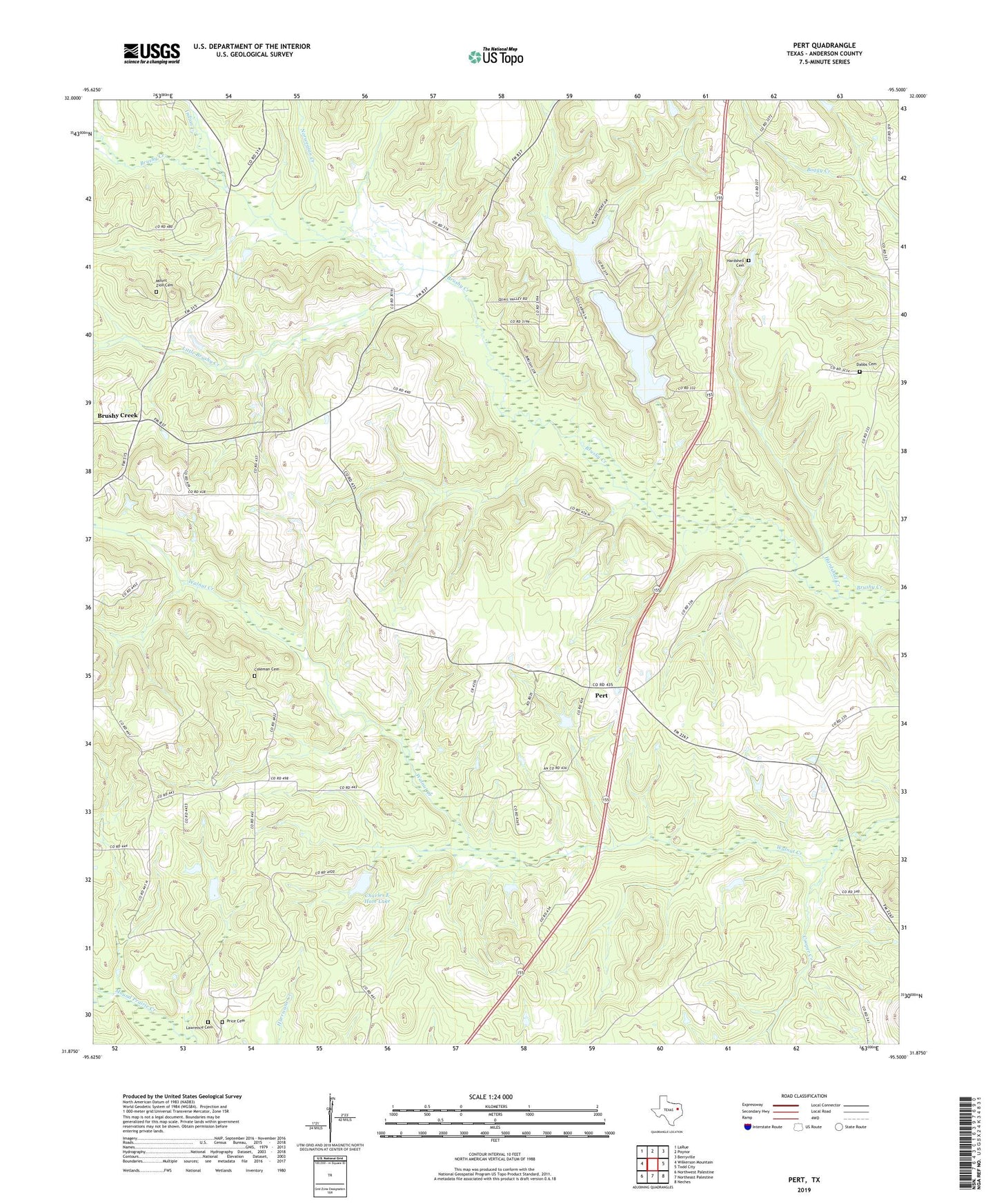
2022 topographic map quadrangle Pert in the state of Texas. Scale: 1:24000. Based on the newly updated USGS 7.5' US Topo map series, this map is in the following counties: Anderson. The map contains contour data, water features, and other items you are used to seeing on USGS maps, but also has updated roads and other features. This is the next generation of topographic maps. Printed on high-quality waterproof paper with UV fade-resistant inks.
Quads adjacent to this one:
West: Wilkerson Mountain
Northwest: LaRue
North: Poynor
Northeast: Berryville
East: Todd City
Southeast: Neches
South: Northeast Palestine
Southwest: Northwest Palestine
This map covers the same area as the classic USGS quad with code o31095h5.
Contains the following named places: Anderson Camp Ground, Brushy Creek, Brushy Creek Church, Brushy Creek School, Charles E Ham Lake, Charles E Ham Lake Dam, Coleman Cemetery, Cooper Creek, Dabbs Cemetery, Frankston Division, Hardshell Cemetery, Hardshell Church, Hardshell Creek, Indian Creek, Lake Frankston, Lake Frankston Dam, Lawrence Cemetery, Little Brushy Creek, Mount Pleasant Church, Mount Zion Cemetery, Mount Zion Church, Norwegian Creek, Oak Grove Church, Olive Branch Church, Pert, Pert Church, Pigsah Church, Pineywoods Lake, Pineywoods Lake Dam, Price Cemetery, Watkins Chapel