MyTopo
Hye Texas US Topo Map
Couldn't load pickup availability
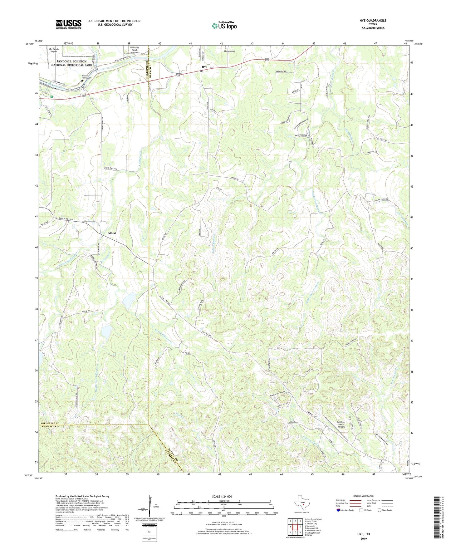
2022 topographic map quadrangle Hye in the state of Texas. Scale: 1:24000. Based on the newly updated USGS 7.5' US Topo map series, this map is in the following counties: Blanco, Gillespie, Kendall. The map contains contour data, water features, and other items you are used to seeing on USGS maps, but also has updated roads and other features. This is the next generation of topographic maps. Printed on high-quality waterproof paper with UV fade-resistant inks.
Quads adjacent to this one:
West: Stonewall
Northwest: Cave Creek School
North: Rocky Creek
Northeast: Johnson City
East: Monument Hill
Southeast: Blanco
South: Crabapple Creek
Southwest: Whitworth Ranch
This map covers the same area as the classic USGS quad with code o30098b5.
Contains the following named places: Albert, American Church, Bauer Ranch, Circle Bar Ranch, Deike Ranch, East Fork Rocky Creek, East Fork Williams Creek, Harvey Ranch, Hye, Hye Airport, Hye Post Office, Johnson Dam, Johnson Family Cemetery, Kennedy Ranch Airport, Kilborn Ranch, LBJ Ranch, LBJ Ranch Airport, Middle Fork Rocky Creek, Middle Fork Williams Creek, Old Junction School, Peese Ranch, Pleasant Hill School, Redstone Ranch Airport, Rocky Community Church, Rocky Creek Ranch, Rocky School, Schumann Ranch, Soil Conservation Service Site 1 Dam, Soil Conservation Service Site 1 Reservoir, Soil Conservation Service Site 2 Dam, Soil Conservation Service Site 2 Reservoir, West Fork Rocky Creek, West Fork Williams Creek, Wilke Ranch, Williams Creek, Wittington Creek, ZIP Code: 78635