MyTopo
Bowser Texas US Topo Map
Couldn't load pickup availability
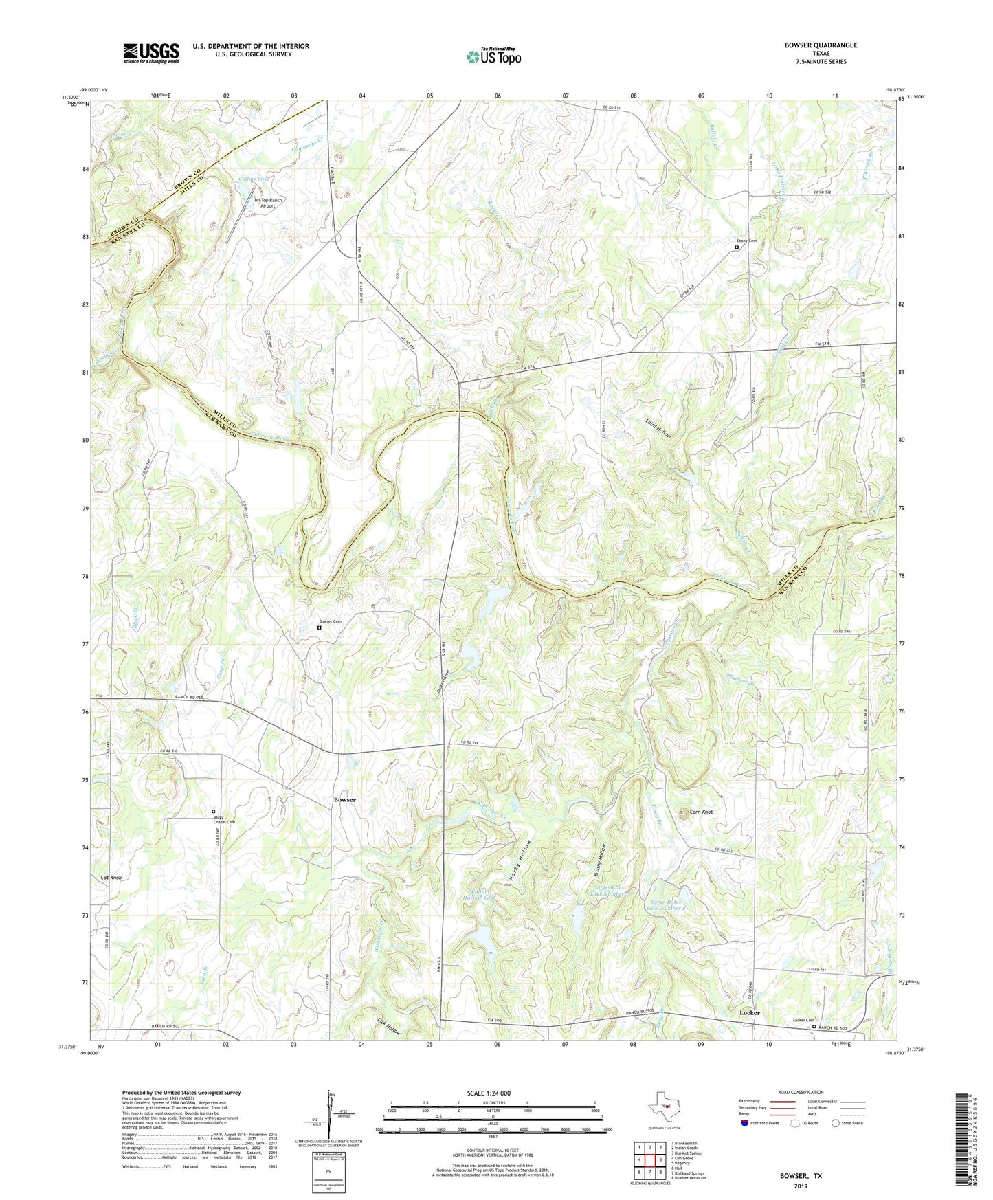
2022 topographic map quadrangle Bowser in the state of Texas. Scale: 1:24000. Based on the newly updated USGS 7.5' US Topo map series, this map is in the following counties: San Saba, Mills, Brown. The map contains contour data, water features, and other items you are used to seeing on USGS maps, but also has updated roads and other features. This is the next generation of topographic maps. Printed on high-quality waterproof paper with UV fade-resistant inks.
Quads adjacent to this one:
West: Elm Grove
Northwest: Brookesmith
North: Indian Creek
Northeast: Blanket Springs
East: Regency
Southeast: Blucher Mountain
South: Richland Springs
Southwest: Hall
This map covers the same area as the classic USGS quad with code o31098d8.
Contains the following named places: Antelope Creek, Black Branch, Bowser, Bowser Cemetery, Brushy Hollow, Buffalo, Buffalo Creek, Cat Knob, Ceder Hollow, Collins Lake, Collins Lake Dam, Comanche Creek, Corn Knob, Ebony Cemetery, Flatrock Branch, Gregory Creek, Harky Hollow, Hogg Branch, Laird Hollow, Lick Hollow, Little Buffalo Creek, Little Flatrock Branch, Locker, Locker Cemetery, Okland Church, Rocky Creek, Rough Creek, Sand Branch, Sofge-Bates Lake Number 1, Sofge-Bates Lake Number 1 Dam, Sofge-Bates Lake Number 2, Sofge-Bates Lake Number 2 Dam, Tin Top Ranch Airport, Vargy Chapel Cemetery, Wilbarger Creek, William Harlow Lake, William Harlow Lake Dam