MyTopo
Big Valley North Texas US Topo Map
Couldn't load pickup availability
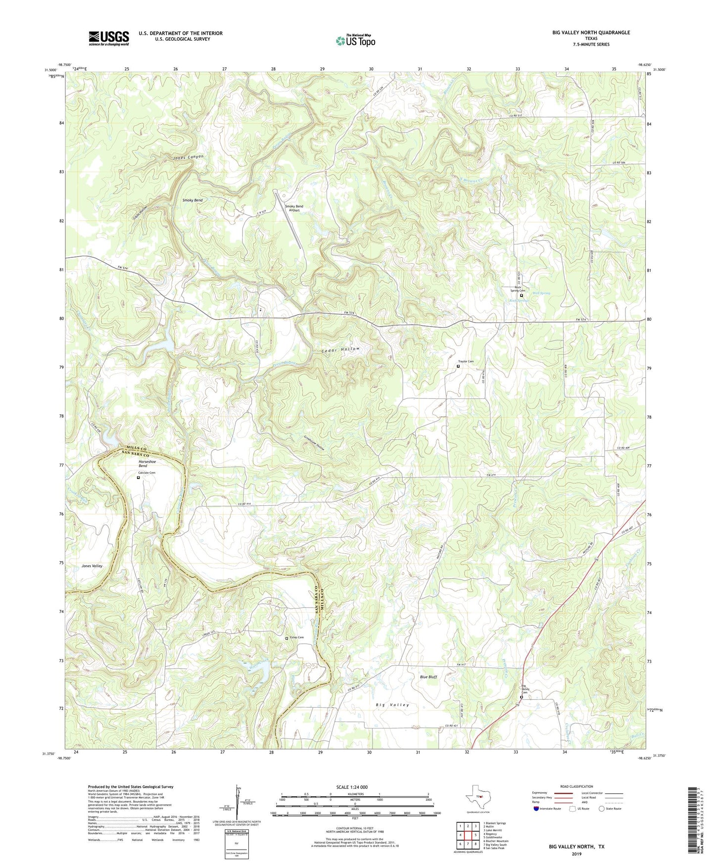
2022 topographic map quadrangle Big Valley North in the state of Texas. Scale: 1:24000. Based on the newly updated USGS 7.5' US Topo map series, this map is in the following counties: Mills, San Saba. The map contains contour data, water features, and other items you are used to seeing on USGS maps, but also has updated roads and other features. This is the next generation of topographic maps. Printed on high-quality waterproof paper with UV fade-resistant inks.
Quads adjacent to this one:
West: Regency
Northwest: Blanket Springs
North: Mullin
Northeast: Lake Merritt
East: Goldthwaite
Southeast: San Saba Peak
South: Big Valley South
Southwest: Blucher Mountain
This map covers the same area as the classic USGS quad with code o31098d6.
Contains the following named places: Barnett Lake, Barnett Lake Dam, Big Valley, Big Valley Cemetery, Big Valley Church, Blue Bluff, Browns Creek, Catclaw Cemetery, Cedar Hollow, Chambers Creek, Crooked Run, Estep Cemetery, Gibbs Hollow, Grindstone Hollow, Horseshoe Bend, Jones Canyon, Mullin Creek, Pecan Bayou, Rock Spring Cemetery, Rock Springs, Smoky Bend, Smoky Bend Airport, Smoky Bend Ranch Airport, South Browns Creek, Traylor Cemetery, Waco Creek, Well Spring