MyTopo
Bay City Texas US Topo Map
Couldn't load pickup availability
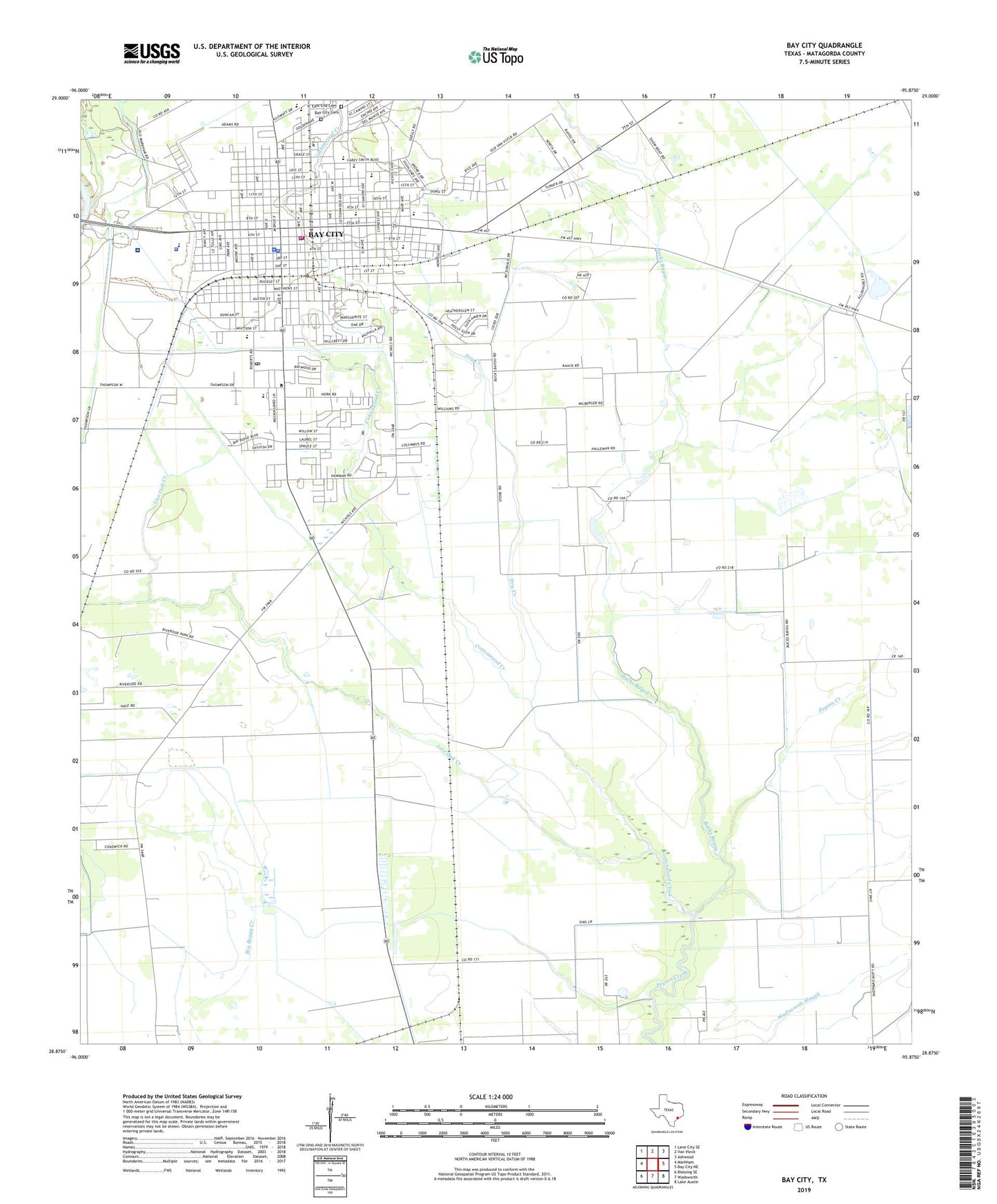
2022 topographic map quadrangle Bay City in the state of Texas. Scale: 1:24000. Based on the newly updated USGS 7.5' US Topo map series, this map is in the following counties: Matagorda. The map contains contour data, water features, and other items you are used to seeing on USGS maps, but also has updated roads and other features. This is the next generation of topographic maps. Printed on high-quality waterproof paper with UV fade-resistant inks.
Quads adjacent to this one:
West: Markham
Northwest: Lane City SE
North: Van Vleck
Northeast: Ashwood
East: Bay City NE
Southeast: Lake Austin
South: Wadsworth
Southwest: Blessing SE
This map covers the same area as the classic USGS quad with code o28095h8.
Contains the following named places: Bay City, Bay City Fire Marshal's Office, Bay City Hall, Bay City Independent School District Police Department, Bay City Junior High School, Bay City Middle School, Bay City Police Department, Bay City Post Office, Bay City Volunteer Fire Department, Bucks Bayou, Cedarvale Bay City Cemetery, City of Bay City, Cottonwood Creek, Dry Creek, East End Cemetery, Fehmel Dusting Service Airport, Hilliard School, Holy Cross School, Jefferson Davis School, John H Cherry Elementary School, KIOX-AM (Bay City), KMKS-FM (Bay City), Linnie Roberts Elementary School, Live Oak Creek, Matagorda County Constable's Office Precinct 1, Matagorda County Courthouse, Matagorda County Emergency Medical Service, Matagorda County Jail, Matagorda County Juvenile Justice Alternative Education School, Matagorda County Museum, Matagorda County Sheriff's Office, Matagorda Regional Medical Center, McAllister Middle School, Pierce Campus Bay City Independent School District Public Information and Communications Office, Tenie Holmes Elementary School