MyTopo
Blowout Texas US Topo Map
Couldn't load pickup availability
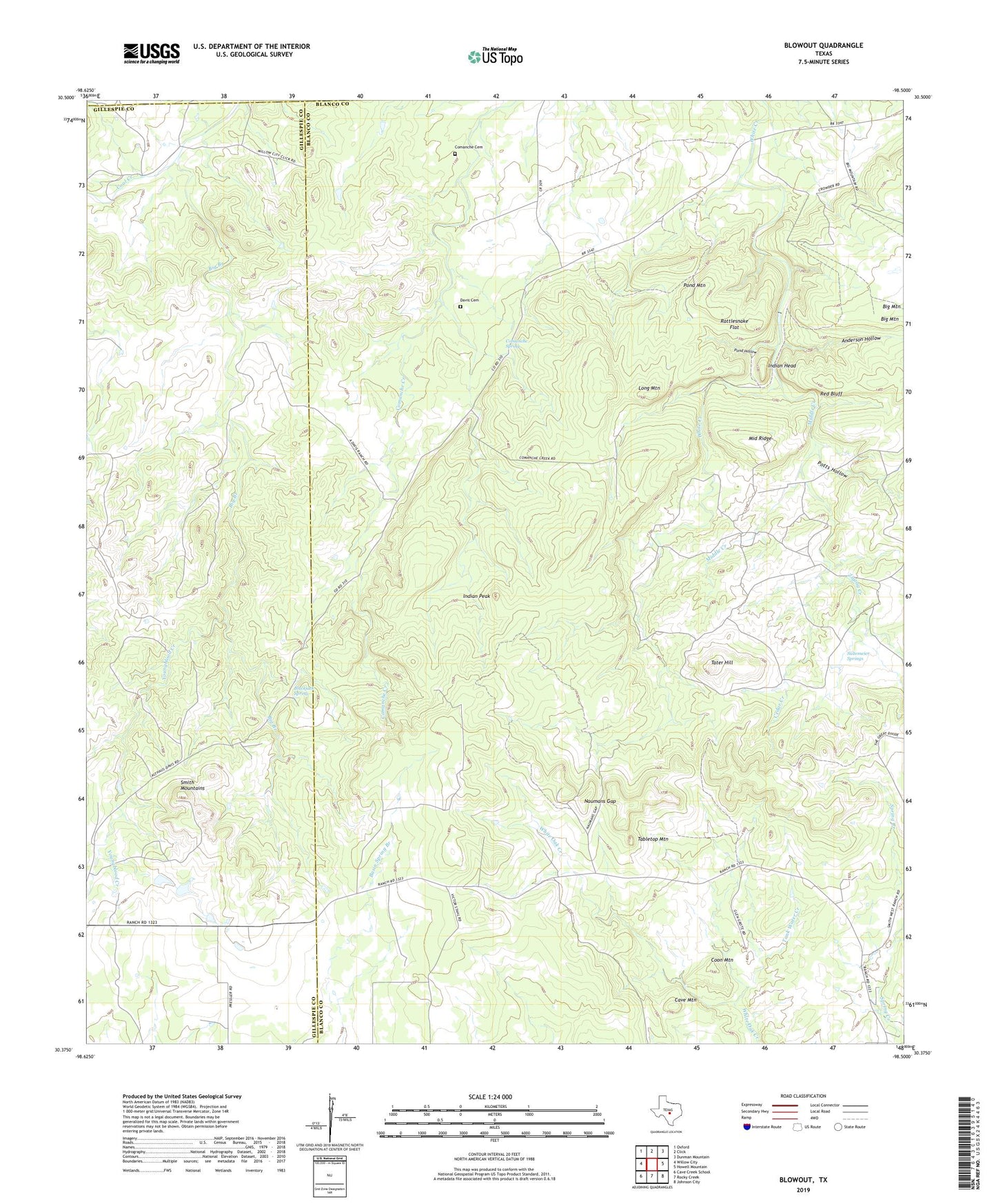
2019 topographic map quadrangle Blowout in the state of Texas. Scale: 1:24000. Based on the newly updated USGS 7.5' US Topo map series, this map is in the following counties: Blanco, Gillespie, Llano. The map contains contour data, water features, and other items you are used to seeing on USGS maps, but also has updated roads and other features. This is the next generation of topographic maps. Printed on high-quality waterproof paper with UV fade-resistant inks.
Quads adjacent to this one:
West: Willow City
Northwest: Oxford
North: Click
Northeast: Dunman Mountain
East: Howell Mountain
Southeast: Johnson City
South: Rocky Creek
Southwest: Cave Creek School
Contains the following named places: Anderson Hollow, Big Branch, Blackjack Spring, Blowout, Cave Mountain, Cedar Creek, Comanche Cemetery, Comanche Spring, Coon Mountain, Davis Cemetery, Indian Head, Indian Peak, Long Mountain, Middle Creek, Middle Ridge, Naumans Gap, Pond Hollow, Pond Mountain, Potts Hollow, Rattlesnake Flat, Red Bluff, Smith Mountains, Sultemeier Springs, Tabletop Mountain, Tank Water Creek, Tater Hill, Youngblood Creek, Zigzag Creek