MyTopo
Oxford Texas US Topo Map
Couldn't load pickup availability
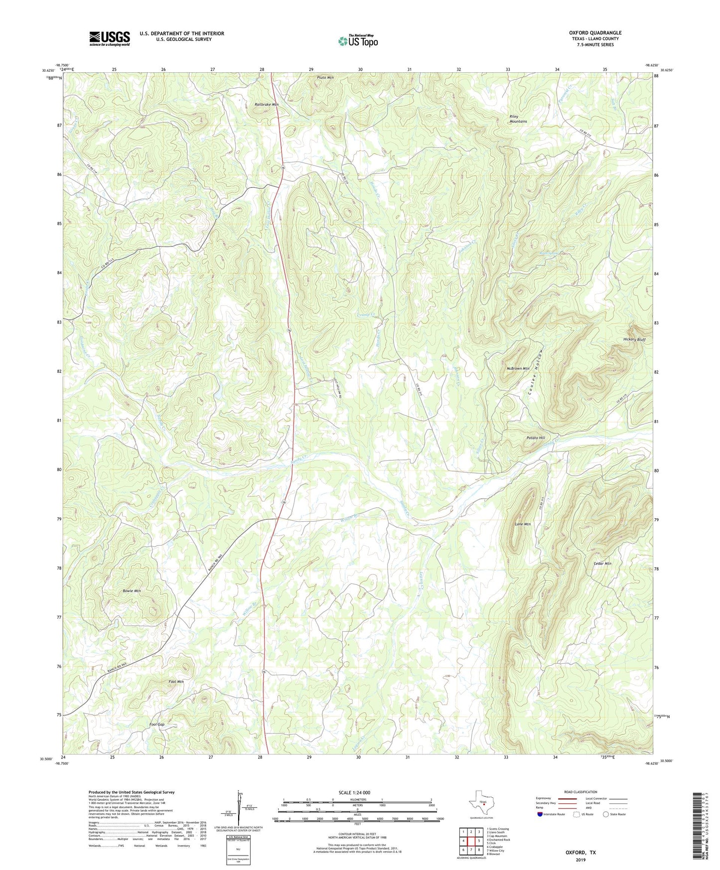
2022 topographic map quadrangle Oxford in the state of Texas. Scale: 1:24000. Based on the newly updated USGS 7.5' US Topo map series, this map is in the following counties: Llano. The map contains contour data, water features, and other items you are used to seeing on USGS maps, but also has updated roads and other features. This is the next generation of topographic maps. Printed on high-quality waterproof paper with UV fade-resistant inks.
Quads adjacent to this one:
West: Enchanted Rock
Northwest: Scotts Crossing
North: Llano South
Northeast: Cap Mountain
East: Click
Southeast: Blowout
South: Willow City
Southwest: Crabapple
This map covers the same area as the classic USGS quad with code o30098e6.
Contains the following named places: Bowie Mountain, Cedar Mountain, Coulee Hollow, Crabapple Creek, Crump Creek, Fool Gap, Fool Mountain, Fowler Ranch, Goldmine Creek, Grape Creek, Hickory Bluff, Hog Branch, Hondo Creek, Johnson Creek, Legion Creek, Llano South Division, Lone Mountain, Lost Hollow Creek, McBrown Mountain, Oxford, Pluto Mountain, Potato Hill, Raab Spring, Railbrake Mountain, Riley Creek, Silver Creek, Willow Branch