MyTopo
Johnson City Texas US Topo Map
Couldn't load pickup availability
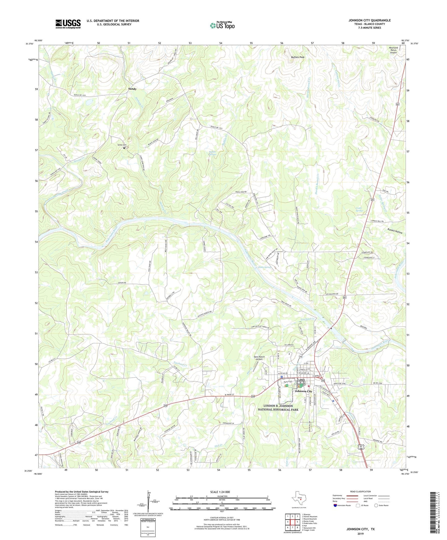
2022 topographic map quadrangle Johnson City in the state of Texas. Scale: 1:24000. Based on the newly updated USGS 7.5' US Topo map series, this map is in the following counties: Blanco. The map contains contour data, water features, and other items you are used to seeing on USGS maps, but also has updated roads and other features. This is the next generation of topographic maps. Printed on high-quality waterproof paper with UV fade-resistant inks.
Quads adjacent to this one:
West: Rocky Creek
Northwest: Blowout
North: Howell Mountain
Northeast: Round Mountain
East: Pedernales Falls
Southeast: Yeager Creek
South: Monument Hill
Southwest: Hye
This map covers the same area as the classic USGS quad with code o30098c4.
Contains the following named places: Blanco County, Blanco County Constable's Office, Blanco County Jail, Blanco County Sheriff's Office, Buffalo Creek, Buffalo Peak, Buffalo Springs, City of Johnson City, Crofts Springs, Danz Ranch Airport, Deer Creek, Flat Creek, Happy Old Folks Home, Hardin Russell Creek, Hickory Creek, Hobbs Spring, Johnson City, Johnson City City Hall, Johnson City Division, Johnson City Police Department, Johnson City Post Office, Johnson City Volunteer Fire Department, Lake Johnson City, Lake Johnson City Dam, North Blanco County Emergency Medical Services, North Grape Creek, Salter Spring Creek, Sandy, Sandy Cemetery, Spring Creek, Towhead Creek, Town Creek, ZIP Code: 78636