MyTopo
Cave Creek School Texas US Topo Map
Couldn't load pickup availability
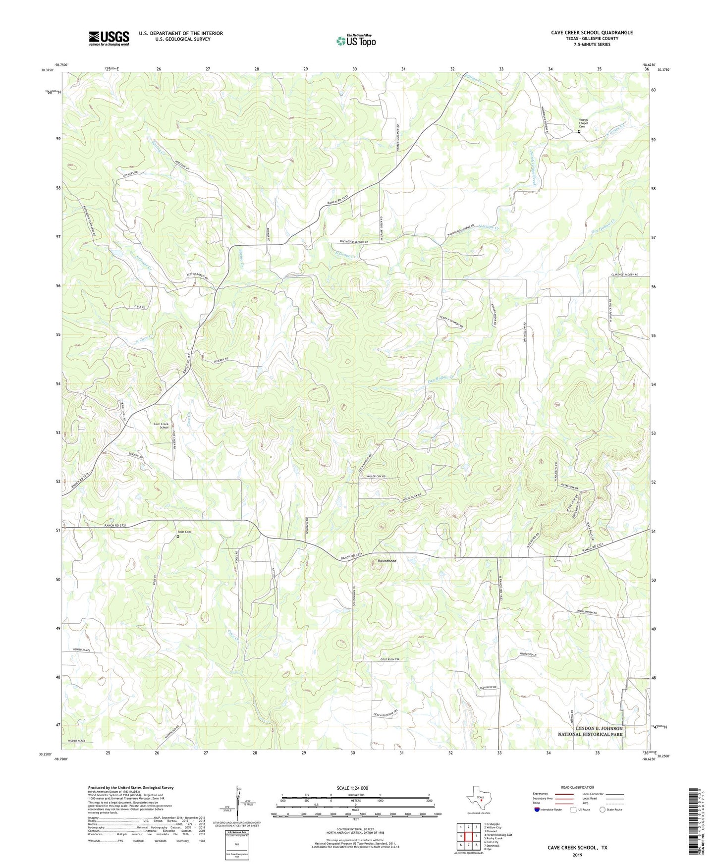
2022 topographic map quadrangle Cave Creek School in the state of Texas. Scale: 1:24000. Based on the newly updated USGS 7.5' US Topo map series, this map is in the following counties: Gillespie. The map contains contour data, water features, and other items you are used to seeing on USGS maps, but also has updated roads and other features. This is the next generation of topographic maps. Printed on high-quality waterproof paper with UV fade-resistant inks.
Quads adjacent to this one:
West: Fredericksburg East
Northwest: Crabapple
North: Willow City
Northeast: Blowout
East: Rocky Creek
Southeast: Hye
South: Stonewall
Southwest: Cain City
This map covers the same area as the classic USGS quad with code o30098c6.
Contains the following named places: Ahrens Ranch, Cave Creek Church, Cave Creek School, Gold Ranch, Koennecke Ranch, North Cave Creek, Ranger City Library, Rhinegold School, Rode Cemetery, Roundhead, Rusk Ranch, Smith Ranch, Spring Creek, Stonewall Division, Willow Creek, Youngs Chapel Cemetery