MyTopo
Howell Mountain Texas US Topo Map
Couldn't load pickup availability
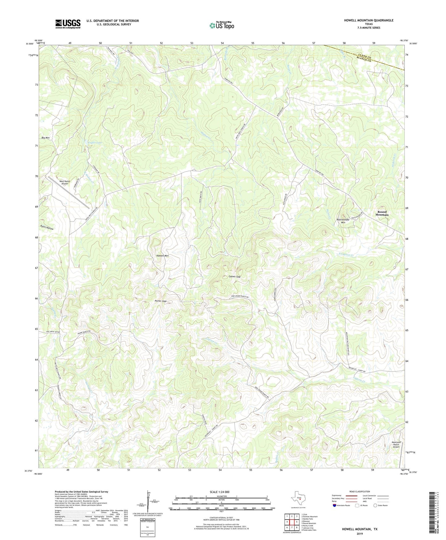
2022 topographic map quadrangle Howell Mountain in the state of Texas. Scale: 1:24000. Based on the newly updated USGS 7.5' US Topo map series, this map is in the following counties: Blanco, Llano. The map contains contour data, water features, and other items you are used to seeing on USGS maps, but also has updated roads and other features. This is the next generation of topographic maps. Printed on high-quality waterproof paper with UV fade-resistant inks.
Quads adjacent to this one:
West: Blowout
Northwest: Click
North: Dunman Mountain
Northeast: Marble Falls
East: Round Mountain
Southeast: Pedernales Falls
South: Johnson City
Southwest: Rocky Creek
This map covers the same area as the classic USGS quad with code o30098d4.
Contains the following named places: Big Mountain, Casner Gap, Howell Mountain, KLNO-TV (Llano), Moursund Ranch Airport, Porter Gap, Rattlesnake Mountain, Taylor Lake, Walnut Hill Church, West Ranch, West Ranch Airport