
MyTopo
Bono Texas US Topo Map
Couldn't load pickup availability
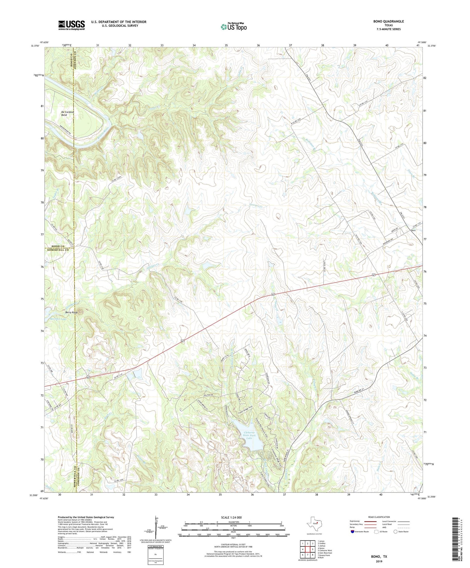
2019 topographic map quadrangle Bono in the state of Texas. Scale: 1:24000. Based on the newly updated USGS 7.5' US Topo map series, this map is in the following counties: Johnson, Somervell, Hood. The map contains contour data, water features, and other items you are used to seeing on USGS maps, but also has updated roads and other features. This is the next generation of topographic maps. Printed on high-quality waterproof paper with UV fade-resistant inks.
Quads adjacent to this one:
West: Nemo
Northwest: Acton
North: Godley
Northeast: Joshua
East: Cleburne West
Southeast: Blum
South: Brazos Point
Southwest: Glen Rose East
Contains the following named places: Berry Knob, Bono, Cedar Creek, Cleburne State Park, Cleburne State Park Dam, Cleburne State Park Lake, Cleburne State Park Trail, McCann Lake, Wilson Creek, Young Lake, Young Lake Dam, ZIP Code: 76033


