MyTopo
Glen Rose East Texas US Topo Map
Couldn't load pickup availability
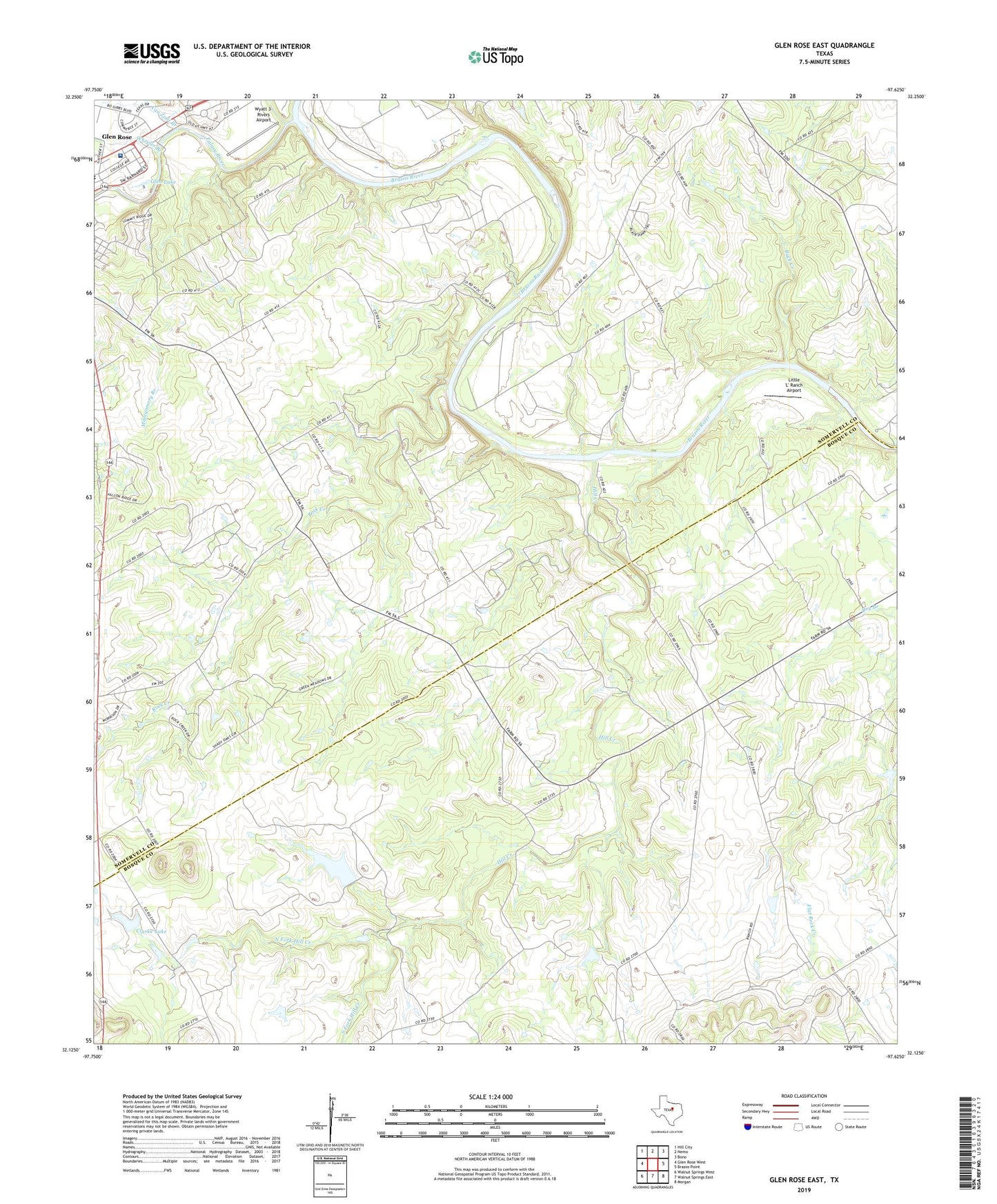
2023 topographic map quadrangle Glen Rose East in the state of Texas. Scale: 1:24000. Based on the newly updated USGS 7.5' US Topo map series, this map is in the following counties: Somervell, Bosque. The map contains contour data, water features, and other items you are used to seeing on USGS maps, but also has updated roads and other features. This is the next generation of topographic maps. Printed on high-quality waterproof paper with UV fade-resistant inks.
Quads adjacent to this one:
West: Glen Rose West
Northwest: Hill City
North: Nemo
Northeast: Bono
East: Brazos Point
Southeast: Morgan
South: Walnut Springs East
Southwest: Walnut Springs West
This map covers the same area as the classic USGS quad with code o32097b6.
Contains the following named places: Buck Creek, Camp Tres Rios, City of Glen Rose, Clarke Lake, Clarke Lake Dam, Eulogy, Glen Lake, Glen Lake Camp, Glen Rose Fire Department, Glen Rose Junior High School, Glen Rose Medical Center, Hill Creek, LifeStar 5 - Southwest Helicopters - Glen Rose, Little 'L' Ranch Airport, North Fork Hill Creek, Paluxy River, Rock Creek, Rock Creek Church, Seven Knobs, South Fork Hill Creek, Squaw Creek, Stufflbeme Dam, Stufflbeme Lake, Van Zant Branch, Wheeler Branch, White Church, Wyatt 3-Rivers Airport