MyTopo
Blum Texas US Topo Map
Couldn't load pickup availability
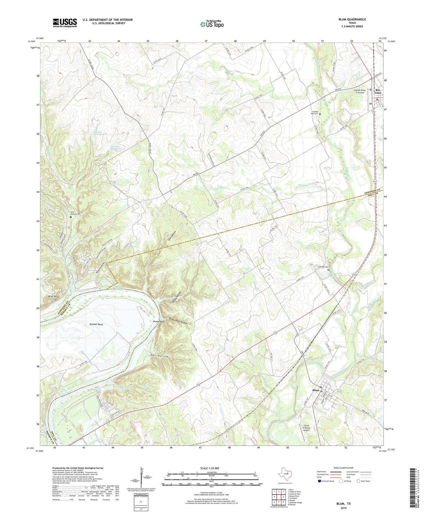
2022 topographic map quadrangle Blum in the state of Texas. Scale: 1:24000. Based on the newly updated USGS 7.5' US Topo map series, this map is in the following counties: Johnson, Hill, Bosque. The map contains contour data, water features, and other items you are used to seeing on USGS maps, but also has updated roads and other features. This is the next generation of topographic maps. Printed on high-quality waterproof paper with UV fade-resistant inks.
Quads adjacent to this one:
West: Brazos Point
Northwest: Bono
North: Cleburne West
Northeast: Cleburne East
East: Covington
Southeast: Blanton
South: Lakeside Village
Southwest: Morgan
This map covers the same area as the classic USGS quad with code o32097b4.
Contains the following named places: Bailey Hollow, Belnap Creek, Big Ham Hole Spring, Bluff Mills, Blum, Blum City Offices, Blum Post Office, Blum Volunteer Fire Department, Broke Rock, Broke Rock Hollow, Chisholm Trail Park, Circle 'A' Ranch Airport, Darr Branch, Elm Hollow, Falls Branch, Fishermans Paradise, Gourd Neck Branch, Grand Valley Lands Airport, Grange Hall Cemetery, Haley Branch, Ham Creek, Ham Creek Park, J T Baker Farmstead, Kimball Bend, Kyle - Bullard Cemetery, Little Ham Hole Spring, Live Oak Cemetery, Lowell Smith Jr Airport, Mustang Creek, Opossum Hollow, Owl Hollow, Pilot Branch, Retreat, Rio Vista Civic Center, Rio Vista Police Department, Rio Vista Post Office, Rio Vista Volunteer Fire Department, Town of Blum, ZIP Code: 76093