MyTopo
Brazos Point Texas US Topo Map
Couldn't load pickup availability
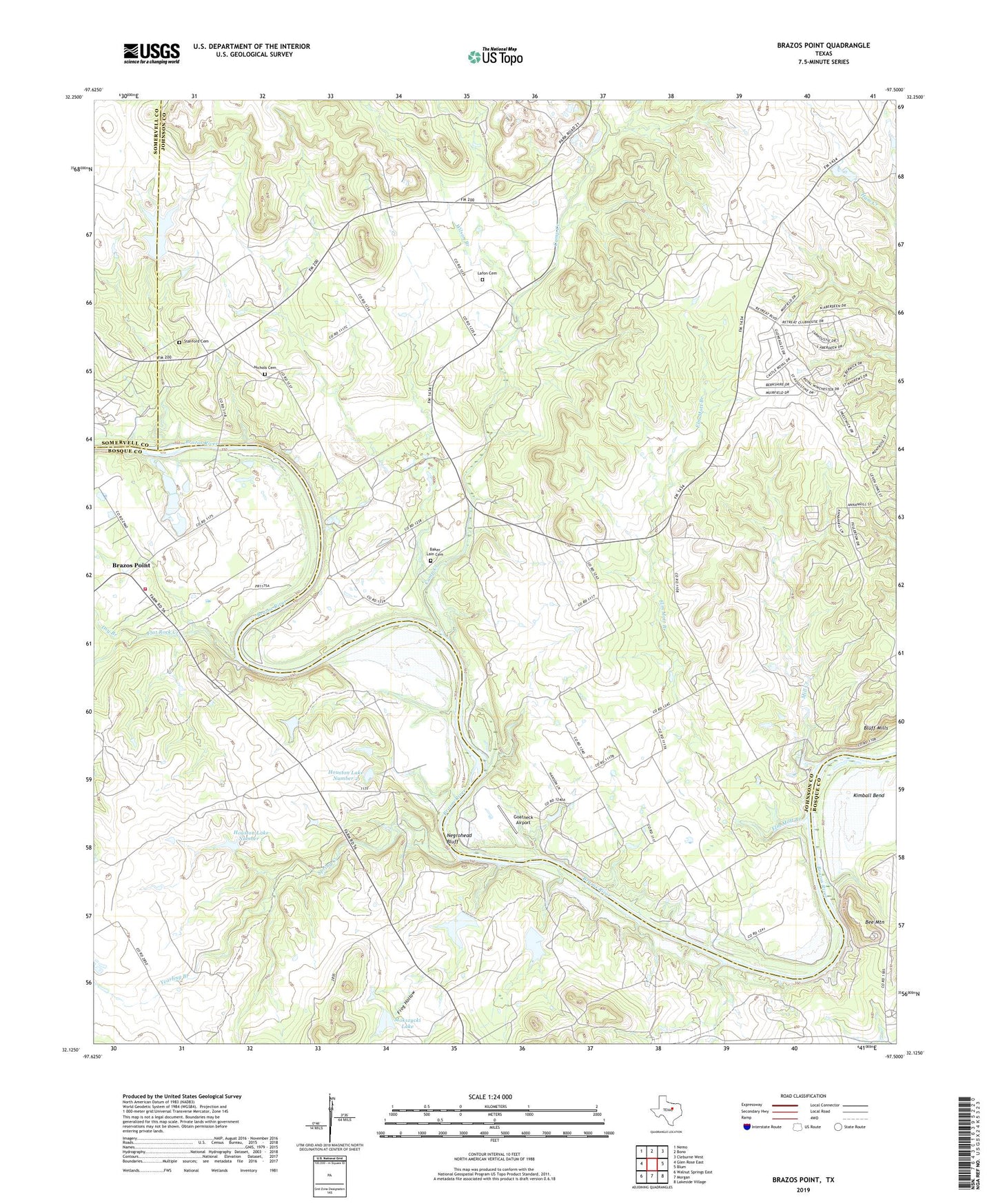
2022 topographic map quadrangle Brazos Point in the state of Texas. Scale: 1:24000. Based on the newly updated USGS 7.5' US Topo map series, this map is in the following counties: Johnson, Bosque, Somervell. The map contains contour data, water features, and other items you are used to seeing on USGS maps, but also has updated roads and other features. This is the next generation of topographic maps. Printed on high-quality waterproof paper with UV fade-resistant inks.
Quads adjacent to this one:
West: Glen Rose East
Northwest: Nemo
North: Bono
Northeast: Cleburne West
East: Blum
Southeast: Lakeside Village
South: Morgan
Southwest: Walnut Springs East
This map covers the same area as the classic USGS quad with code o32097b5.
Contains the following named places: Baker Lain Cemetery, Bee Mountain, Brazos Point, Brazos Point - Eulogy Volunteer Fire Department / Ambulance Service, Camp Creek, Dry Branch, Elm Mott Branch, Flat Rock Creek, Freeland, Frog Hollow, Goatneck Airport, Hendrick Arnold Bluff, Highland, Houston Lake Number 1, Houston Lake Number 1 Dam, Houston Lake Number 2, Houston Lake Number 2 Dam, Lafon Cemetery, Mill Creek, Mokszycki Lake, Mokszycki Lake Dam, New Hope Church, Nichols Cemetery, Spring Creek, Stanford Cemetery, West Fork Camp Creek, Wilson Branch, Yearling Branch