MyTopo
Agua Nueva Texas US Topo Map
Couldn't load pickup availability
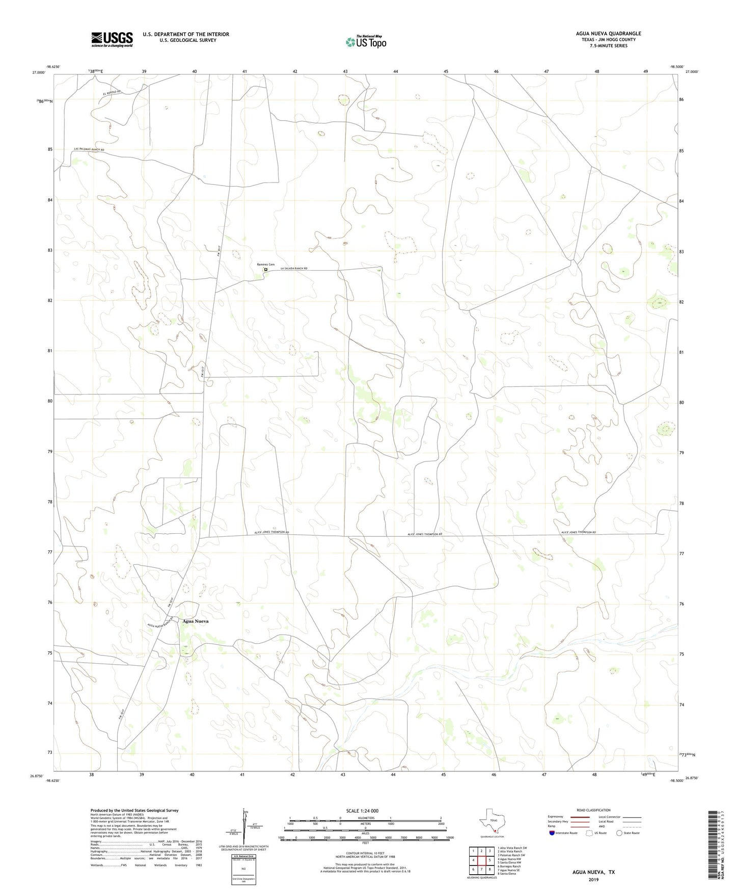
2022 topographic map quadrangle Agua Nueva in the state of Texas. Scale: 1:24000. Based on the newly updated USGS 7.5' US Topo map series, this map is in the following counties: Jim Hogg. The map contains contour data, water features, and other items you are used to seeing on USGS maps, but also has updated roads and other features. This is the next generation of topographic maps. Printed on high-quality waterproof paper with UV fade-resistant inks.
Quads adjacent to this one:
West: Agua Nueva NW
Northwest: Alta Vista Ranch SW
North: Alta Vista Ranch
Northeast: Palomas Ranch SW
East: Santa Elena NW
Southeast: Santa Elena
South: Agua Nueva SE
Southwest: Borregos Ranch
This map covers the same area as the classic USGS quad with code o26098h5.
Contains the following named places: Agua Nueva, Arroyo Windmill, Brazil Windmill, Buena Suerte Windmill, Chapote Windmill, Charco Largo Windmill, Copa Windmill, Escobedo Windmill, Huella Windmill, Loma Windmill, Manuel Windmill, Marino Windmill, Palomas Ranch, Papalote Windmill, Pita Windmill, Plato Windmill, Ramirez Cemetery, Rosita Windmill, Salada Windmill, Salado Windmill, San Carlos Windmill, San Guadalupe Windmill, San Juan Windmill, San Lazaro Windmill, Sand Windmill, Serita Windmill, Soledad Windmill, Square Tank Windmill, Taco Windmill, Toro Windmill, Tres Lagunas Windmill