MyTopo
Fortune Bend Texas US Topo Map
Couldn't load pickup availability
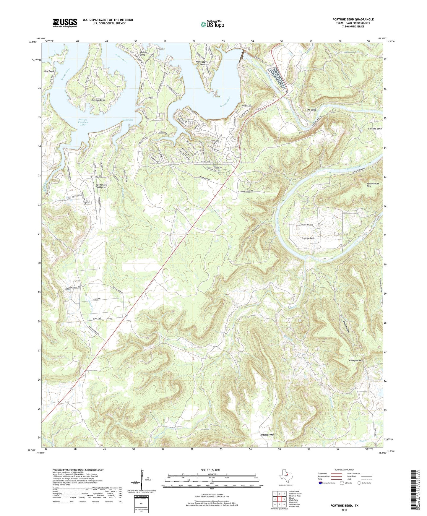
2022 topographic map quadrangle Fortune Bend in the state of Texas. Scale: 1:24000. Based on the newly updated USGS 7.5' US Topo map series, this map is in the following counties: Palo Pinto. The map contains contour data, water features, and other items you are used to seeing on USGS maps, but also has updated roads and other features. This is the next generation of topographic maps. Printed on high-quality waterproof paper with UV fade-resistant inks.
Quads adjacent to this one:
West: Brad
Northwest: Cove Creek
North: Costello Island
Northeast: Graford West
East: Palo Pinto
Southeast: Lone Camp
South: Metcalf Gap
Southwest: Caddo NE
This map covers the same area as the classic USGS quad with code o32098g4.
Contains the following named places: Belding Oil Field, Belding Ranch, Bluff Creek, Camp Constantin, Crawford Hollow, Doan Hollow, Flint Bend, Fortune Bend, Frank Harris Bend, Gaines Bend, Garland Bend, Harris Branch, Hells Gate, Hog Bend, Ioni Creek, Johnson Bend, Jowell Creek, Loving Creek, Morris Sheppard Dam, Pecan Hollow, Schoolhouse Mountain, Sportsman's World Airport