MyTopo
Bradshaw Texas US Topo Map
Couldn't load pickup availability
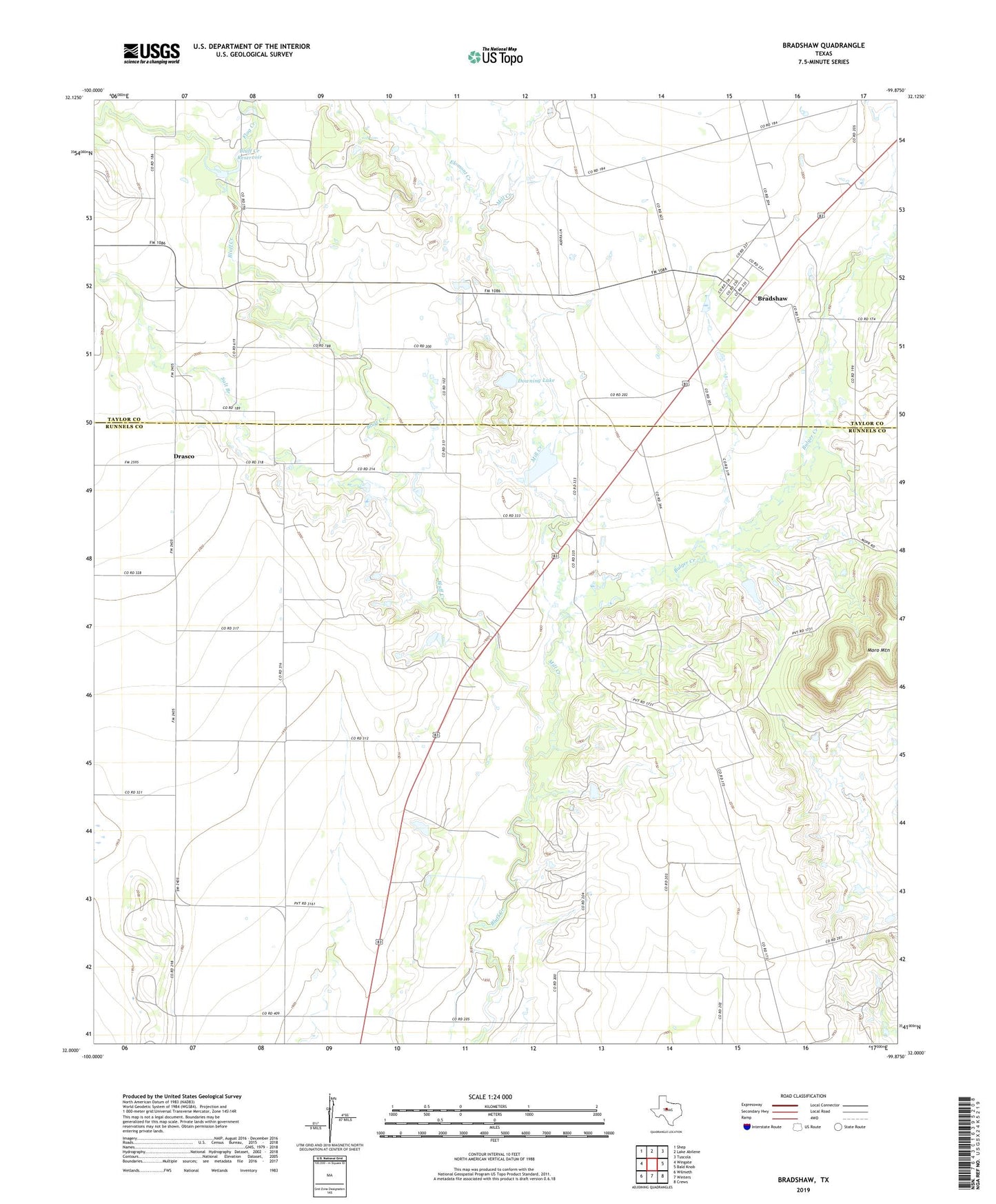
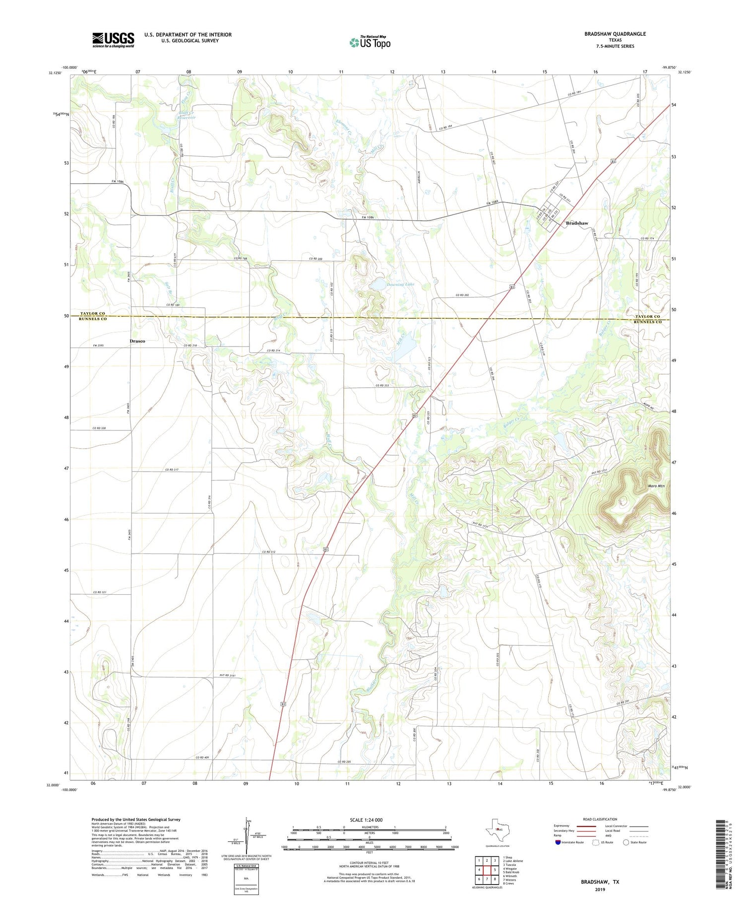
2019 topographic map quadrangle Bradshaw in the state of Texas. Scale: 1:24000. Based on the newly updated USGS 7.5' US Topo map series, this map is in the following counties: Runnels, Taylor. The map contains contour data, water features, and other items you are used to seeing on USGS maps, but also has updated roads and other features. This is the next generation of topographic maps. Printed on high-quality waterproof paper with UV fade-resistant inks.
Quads adjacent to this one:
West: Wingate
Northwest: Shep
North: Lake Abilene
Northeast: Tuscola
East: Bald Knob
Southeast: Crews
South: Winters
Southwest: Wilmeth
Contains the following named places: Bluff Creek Dam, Bluff Creek Reservoir, Bradshaw, Bradshaw Cemetery, Bulger Creek, Downing Dam, Downing Lake, Drasco, Elomont Creek, Flag Creek, Mill Creek, Salt Branch