MyTopo
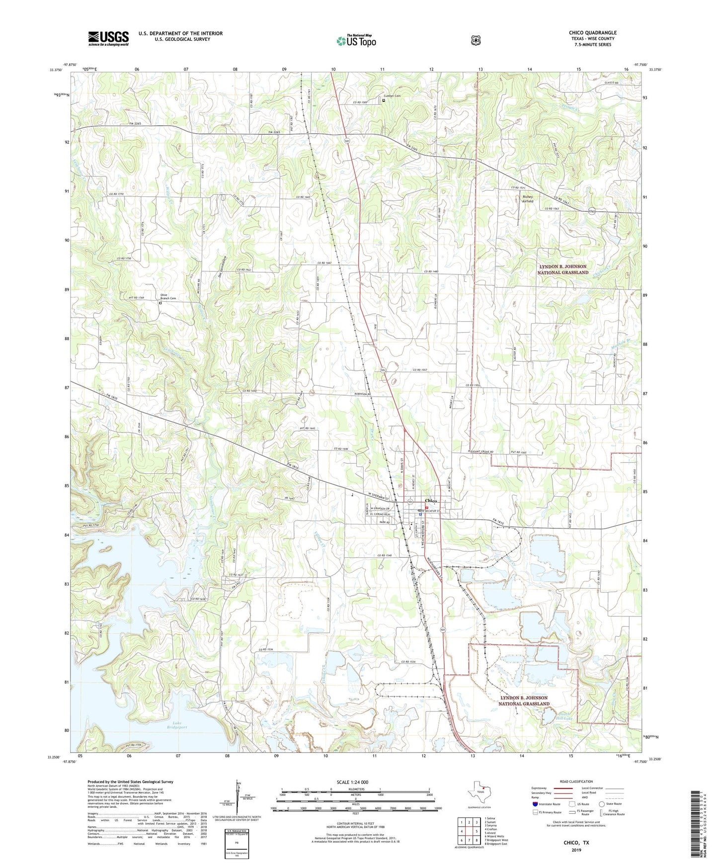
Chico Texas US Topo Map
Couldn't load pickup availability
Also explore the Chico Forest Service Topo of this same quad for updated USFS data
2022 topographic map quadrangle Chico in the state of Texas. Scale: 1:24000. Based on the newly updated USGS 7.5' US Topo map series, this map is in the following counties: Wise. The map contains contour data, water features, and other items you are used to seeing on USGS maps, but also has updated roads and other features. This is the next generation of topographic maps. Printed on high-quality waterproof paper with UV fade-resistant inks.
Quads adjacent to this one:
West: Crafton
Northwest: Selma
North: Sunset
Northeast: Smyrna
East: Alvord
Southeast: Bridgeport East
South: Bridgeport West
Southwest: Wizard Wells
This map covers the same area as the classic USGS quad with code o33097c7.
Contains the following named places: Alvord Oil Field, Big Creek, Chico, Chico Cemetery, Chico Community Volunteer Fire Department, Chico Elementary School, Chico Middle School, Chico Police Department, Chico Post Office, City of Chico, Cumber Cemetery, Doc Gan Hollow, J T Brown Hotel, Miles Jackson Oil Field, Olive Branch Cemetery, Peach Hill Lake, Peach Hill Plant Dam, Red Bud Church, Richey Airfield, Venchoner Creek, Willow Creek, Wise County Constable's Office Precinct 2, ZIP Code: 76431