MyTopo
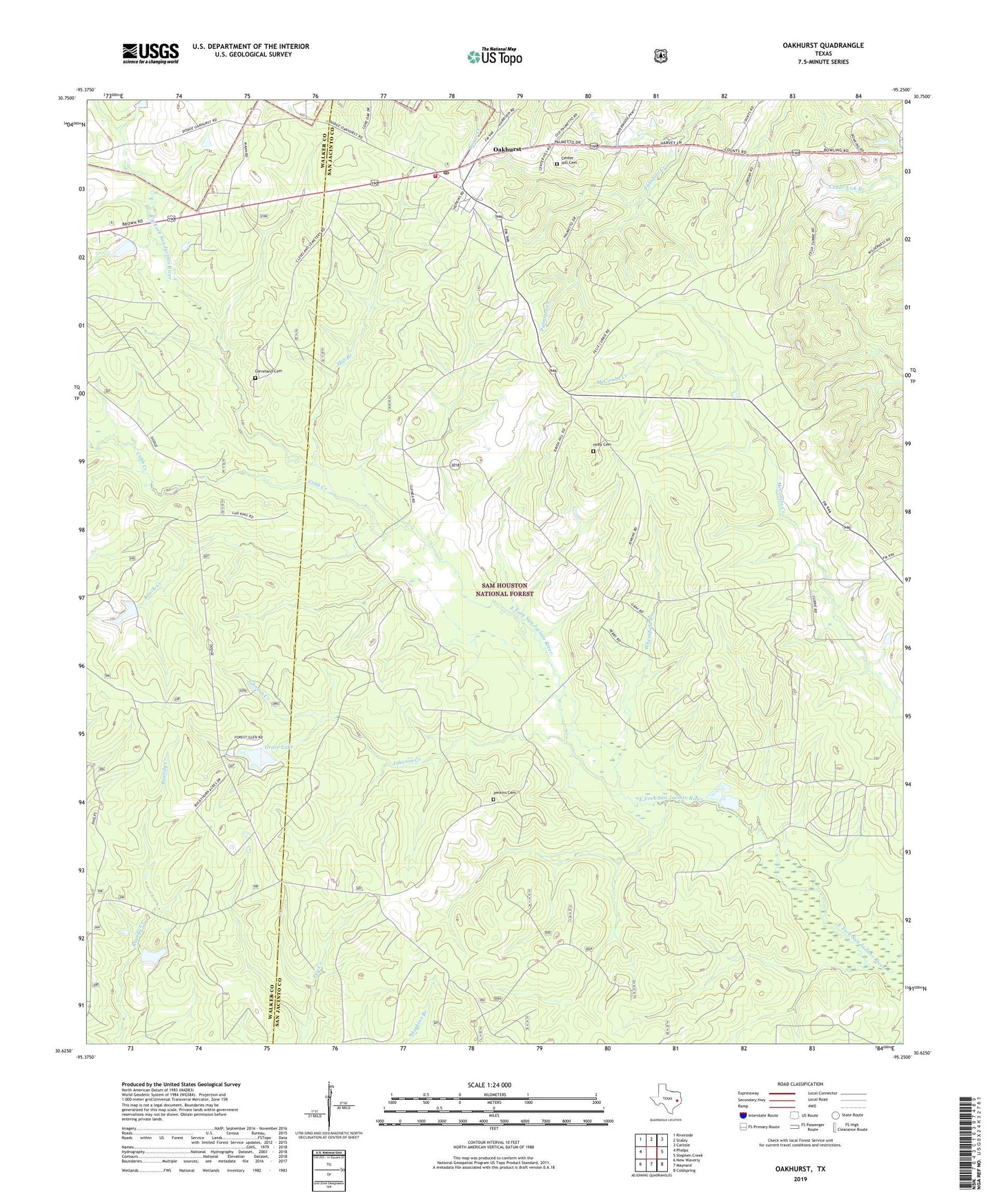
Oakhurst Texas US Topo Map
Couldn't load pickup availability
Also explore the Oakhurst Forest Service Topo of this same quad for updated USFS data
2022 topographic map quadrangle Oakhurst in the state of Texas. Scale: 1:24000. Based on the newly updated USGS 7.5' US Topo map series, this map is in the following counties: San Jacinto, Walker. The map contains contour data, water features, and other items you are used to seeing on USGS maps, but also has updated roads and other features. This is the next generation of topographic maps. Printed on high-quality waterproof paper with UV fade-resistant inks.
Quads adjacent to this one:
West: Phelps
Northwest: Riverside
North: Staley
Northeast: Carlisle
East: Stephen Creek
Southeast: Coldspring
South: Maynard
Southwest: New Waverly
This map covers the same area as the classic USGS quad with code o30095f3.
Contains the following named places: Center Hill Cemetery, Center Hill Church, Cleveland Cemetery, Cobb Creek, Enterprise Church, Grace Lake, Grace Lake Dam, Hoby Cemetery, Hoby Church, Hopewell Church, Jenkins Cemetery, Johnson Creek, Maple Hill Church, Mill Branch, Mount Gideon Church, Oakhurst, Oakhurst Census Designated Place, Oakhurst Post Office, Oakhurst School, Oakhurst Volunteer Fire Department, Palmetto Park, Raven Hill Historical Monument, Roark Creek, Wheatfield Branch, White Hill Missionary Church