MyTopo
Valley Spring Texas US Topo Map
Couldn't load pickup availability
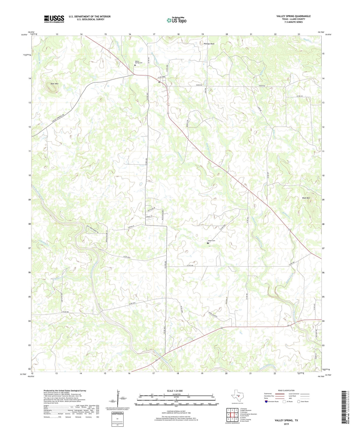
2022 topographic map quadrangle Valley Spring in the state of Texas. Scale: 1:24000. Based on the newly updated USGS 7.5' US Topo map series, this map is in the following counties: Llano. The map contains contour data, water features, and other items you are used to seeing on USGS maps, but also has updated roads and other features. This is the next generation of topographic maps. Printed on high-quality waterproof paper with UV fade-resistant inks.
Quads adjacent to this one:
West: Smoothingiron Mountain
Northwest: Pontotoc
North: Magill Mountain
Northeast: Cherokee
East: Llano North
Southeast: Llano South
South: Scotts Crossing
Southwest: Castell
This map covers the same area as the classic USGS quad with code o30098g7.
Contains the following named places: Deer Mountain, North Willow Creek, Phillips Rock, Salem Cemetery, Sand Spring Creek, Shiloh Church, South Willow Creek, Valley Spring, Valley Spring Cemetery, Valley Spring Post Office, Willow Creek, Wolf Mountain, ZIP Code: 76885