MyTopo
Covington Texas US Topo Map
Couldn't load pickup availability
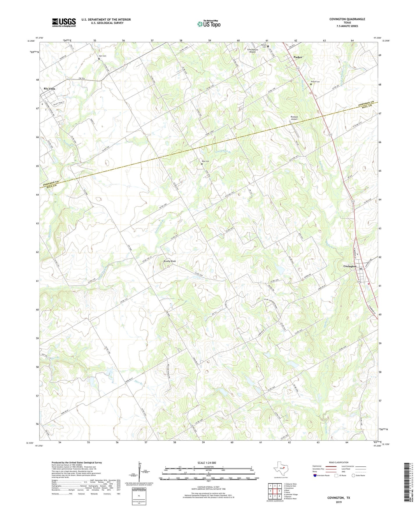
2022 topographic map quadrangle Covington in the state of Texas. Scale: 1:24000. Based on the newly updated USGS 7.5' US Topo map series, this map is in the following counties: Hill, Johnson. The map contains contour data, water features, and other items you are used to seeing on USGS maps, but also has updated roads and other features. This is the next generation of topographic maps. Printed on high-quality waterproof paper with UV fade-resistant inks.
Quads adjacent to this one:
West: Blum
Northwest: Cleburne West
North: Cleburne East
Northeast: Grandview
East: Itasca
Southeast: Hillsboro West
South: Blanton
Southwest: Lakeside Village
This map covers the same area as the classic USGS quad with code o32097b3.
Contains the following named places: Birdnest Airport, Brushy Knob, City of Covington, City of Rio Vista, Covington, Covington Cemetery, Covington City Offices, Covington Post Office, Covington Volunteer Fire Department, Cow Pasture Airport, Cross Wind Acres Airport, Derden, Gilmer and Walker Lake, Gilmer and Walker Lake Dam, Hart Cemetery, Kinard Cemetery, Meredith Hart House, Parker, Parker Cemetery, Rio Vista, Rio Vista Elementary School, Ross Cemetery, Saint Johns Church, Sky Vista Ranch Airport, Soil Conservation Service Site 2 Dam, Soil Conservation Service Site 2 Reservoir, Soil Conservation Service Site 3 Dam, Soil Conservation Service Site 3 Reservoir, Union Hill Church, Woodrow, ZIP Code: 76636