
MyTopo
Comanche Texas US Topo Map
Couldn't load pickup availability
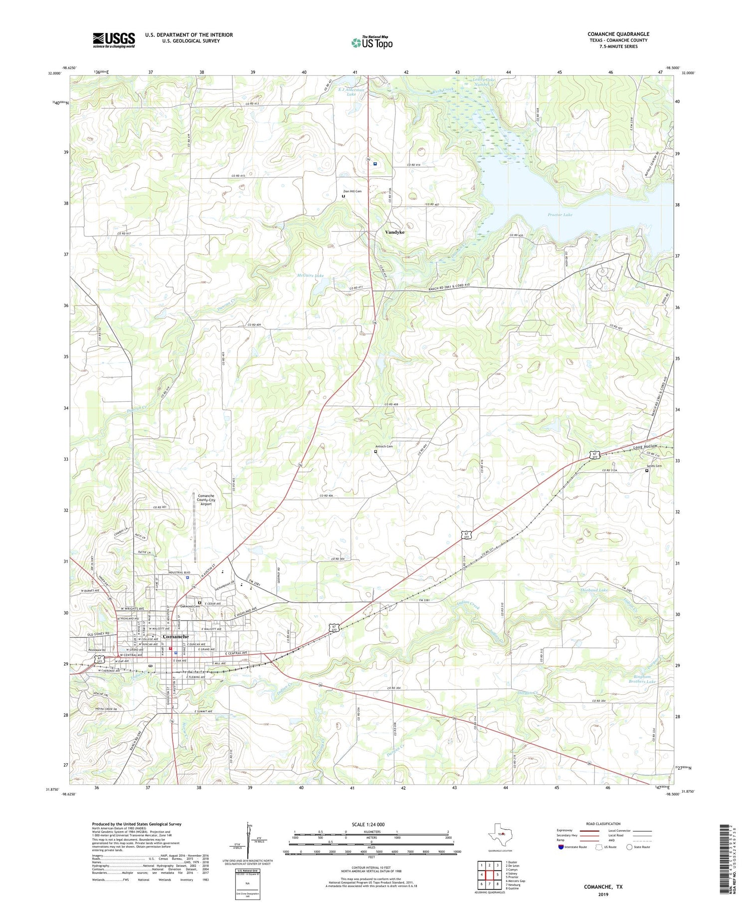
2019 topographic map quadrangle Comanche in the state of Texas. Scale: 1:24000. Based on the newly updated USGS 7.5' US Topo map series, this map is in the following counties: Comanche. The map contains contour data, water features, and other items you are used to seeing on USGS maps, but also has updated roads and other features. This is the next generation of topographic maps. Printed on high-quality waterproof paper with UV fade-resistant inks.
Quads adjacent to this one:
West: Sidney
Northwest: Duster
North: De Leon
Northeast: Comyn
East: Proctor
Southeast: Gustine
South: Newburg
Southwest: Mercers Gap
Contains the following named places: Antioch Cemetery, Armstrong Creek, Bingham Brothers Dam, Bingham Brothers Lake, Church of Christ, City of Comanche, Comanche, Comanche City Hall, Comanche City Park, Comanche Community Hospital, Comanche County, Comanche County Constable's Office, Comanche County Medical Center, Comanche County Sheriff's Office, Comanche County-City Airport, Comanche Intermediate School, Comanche Police Department, Comanche Post Office, Comanche Primary School, Comanche Stadium, Comanche Volunteer Fire Department, Copperas Creek Park, Duncan Creek, E J Alderman Lake, First Baptist Church, Gartman View, Good Shepherd Baptist Church, Grace Baptist Church, Hope Lutheran Church, Horse Creek, Indian Creek Cemetery, Indian Creek Church, J B Layne School, Jefferies Junior High School, KCOM-AM (Comanche), McGuire Dam, McGuire Lake, Mesa Lake School, Mount Pleasant Church, Oakwood Cemetery, Proctor Dam, Promontory Park, Saint Matthew Episcopal Church, Sardis Cemetery, The Church of Jesus Christ of Latter Day Saints, Thiebaud Dam, Thiebaud Lake, Vandyke, Zion Hill Cemetery, ZIP Code: 76442


